
Michigan County Outline Map: Free Printable Blank Templates & Study Key
High-resolution blank Michigan county outline maps for educators, students, researchers, and graphic designers. Includes crisp vector PDF printables, transparent PNG files, an 83-county study key, and classroom curriculum guides.
Download Free Blank Michigan County Outline Maps
Precision-drawn boundary outlines ready for immediate US Letter printing (8.5″ x 11″) or high-resolution graphic software editing.
High-Resolution Michigan Blank County Outline Preview
Below is the official blank outline cartographic diagram of Michigan. Both the Upper and Lower Peninsulas are accurately represented with complete jurisdictional borders for all 83 counties, including offshore island groups such as Isle Royale (Keweenaw County), Beaver Island (Charlevoix County), Drummond Island (Chippewa County), and Mackinac Island (Mackinac County).
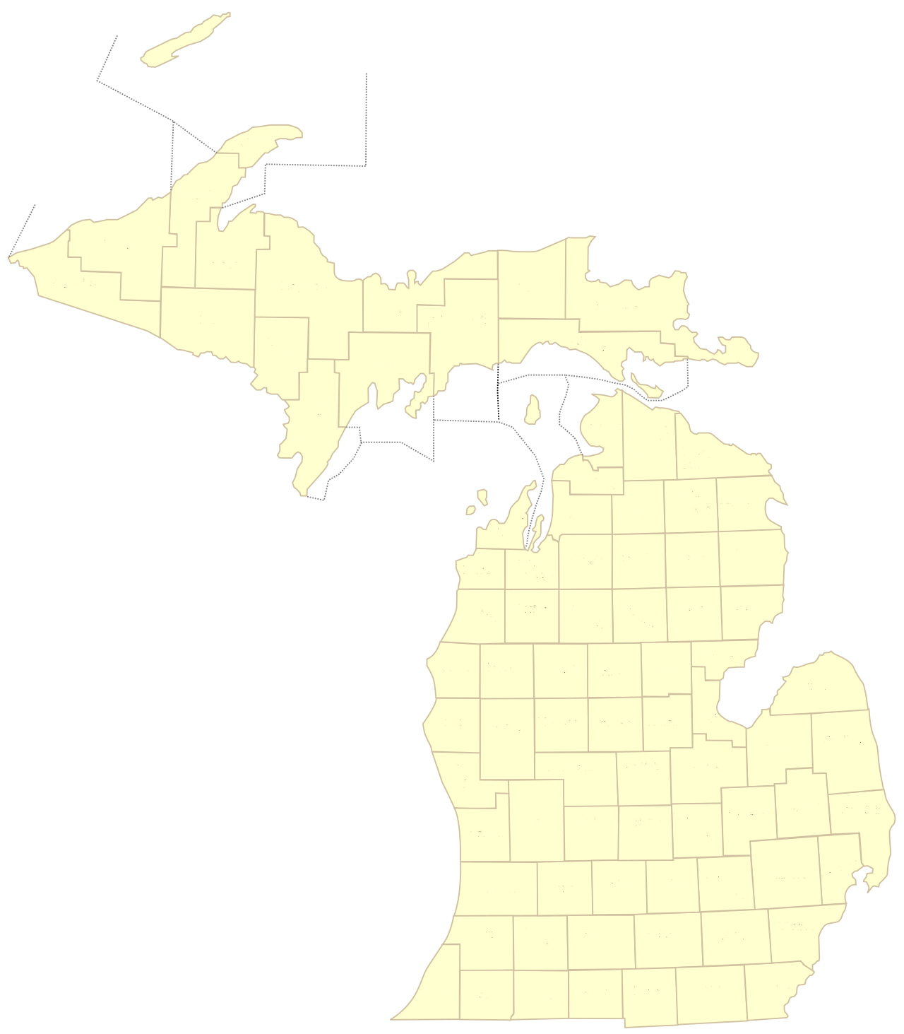
Figure 1: Official Michigan County Outline Map with blank borders suitable for testing, geography exercises, and data plotting.
How to Use the Michigan Blank County Outline Map
1. K-12 Social Studies & Geography Quizzes
Print out copies for classroom geography drills. Students can label each of the 83 counties, locate the state capital (Lansing in Ingham County), and identify major natural boundaries including Lake Michigan, Lake Superior, Lake Huron, and Lake Erie.
2. Business Sales Territories & Logistics
Sales directors, logistics coordinators, and field representatives utilize blank outline maps to color-code service territories, distributor zones, emergency response sectors, and delivery routes across Michigan’s regional markets.
3. Political & Election Data Visualization
Analysts and journalists use unlabelled county templates to render voter turnout chloropleth maps, historical voting patterns, demographic shifts, and regional ballot initiative breakdowns.
4. Crafting, Laser Cutting & DIY Art
Woodworkers, vinyl crafters, and graphic artists import our high-resolution PNG outline into design software like Adobe Illustrator, CorelDRAW, or Cricut Design Space for woodworking templates and custom vinyl decals.
Michigan Counties Reference Key (Alphabetical 1 to 83)
Use this numbered answer key alongside your blank outline map for self-testing or grading classroom assignments.
| # | County Name | County Seat | Geographic Region | Population (2026) |
|---|---|---|---|---|
| 1 | Alcona County | Harrisville | Northern Lower | 10,167 |
| 2 | Alger County | Munising | Upper Peninsula | 8,769 |
| 3 | Allegan County | Allegan | West Michigan | 120,502 |
| 4 | Alpena County | Alpena | Northern Lower | 28,907 |
| 5 | Antrim County | Bellaire | Northern Lower | 23,431 |
| 6 | Arenac County | Standish | Mid-Michigan | 15,002 |
| 7 | Baraga County | L’Anse | Upper Peninsula | 8,158 |
| 8 | Barry County | Hastings | West Michigan | 62,422 |
| 9 | Bay County | Bay City | Great Lakes Bay | 103,856 |
| 10 | Benzie County | Beulah | Northern Lower | 17,970 |
| 11 | Berrien County | St. Joseph | Southwest Michigan | 154,316 |
| 12 | Branch County | Coldwater | Southern Border | 44,862 |
| 13 | Calhoun County | Marshall | Southwest Michigan | 134,310 |
| 14 | Cass County | Cassopolis | Southwest Michigan | 51,589 |
| 15 | Charlevoix County | Charlevoix | Northern Lower | 26,054 |
| 16 | Cheboygan County | Cheboygan | Northern Lower | 25,579 |
| 17 | Chippewa County | Sault Ste. Marie | Upper Peninsula | 36,785 |
| 18 | Clare County | Harrison | Central Michigan | 30,856 |
| 19 | Clinton County | St. Johns | Mid-Michigan | 79,128 |
| 20 | Crawford County | Grayling | Northern Lower | 12,988 |
| 21 | Delta County | Escanaba | Upper Peninsula | 36,903 |
| 22 | Dickinson County | Iron Mountain | Upper Peninsula (Central Time) | 25,947 |
| 23 | Eaton County | Charlotte | Mid-Michigan | 109,175 |
| 24 | Emmet County | Petoskey | Northern Lower | 34,057 |
| 25 | Genesee County | Flint | Flint / Mid-Michigan | 406,211 |
| 26 | Gladwin County | Gladwin | Central Michigan | 25,386 |
| 27 | Gogebic County | Bessemer | Upper Peninsula (Central Time) | 14,380 |
| 28 | Grand Traverse County | Traverse City | Northern Lower | 95,238 |
| 29 | Gratiot County | Ithaca | Central Michigan | 41,761 |
| 30 | Hillsdale County | Hillsdale | Southern Border | 45,742 |
| 31 | Houghton County | Houghton | Upper Peninsula | 37,361 |
| 32 | Huron County | Bad Axe | The Thumb | 31,407 |
| 33 | Ingham County | Mason | Capital Region | 284,900 |
| 34 | Ionia County | Ionia | West Michigan | 66,804 |
| 35 | Iosco County | Tawas City | Northern Lower | 25,237 |
| 36 | Iron County | Crystal Falls | Upper Peninsula (Central Time) | 11,631 |
| 37 | Isabella County | Mt. Pleasant | Central Michigan | 64,394 |
| 38 | Jackson County | Jackson | South Central Michigan | 160,366 |
| 39 | Kalamazoo County | Kalamazoo | Southwest Michigan | 261,670 |
| 40 | Kalkaska County | Kalkaska | Northern Lower | 17,939 |
| 41 | Kent County | Grand Rapids | West Michigan Hub | 657,974 |
| 42 | Keweenaw County | Eagle River | Upper Peninsula (Copper Country) | 2,172 |
| 43 | Lake County | Baldwin | West Central Michigan | 12,096 |
| 44 | Lapeer County | Lapeer | The Thumb / Metro Fringe | 88,619 |
| 45 | Leelanau County | Suttons Bay | Northern Lower | 22,301 |
| 46 | Lenawee County | Adrian | Southern Border | 99,423 |
| 47 | Livingston County | Howell | Metro Detroit Fringe | 194,385 |
| 48 | Luce County | Newberry | Upper Peninsula | 5,339 |
| 49 | Mackinac County | St. Ignace | Upper Peninsula (Straits) | 10,834 |
| 50 | Macomb County | Mount Clemens | Metro Detroit / Lake St. Clair | 881,217 |
| 51 | Manistee County | Manistee | Northern Lower | 25,032 |
| 52 | Marquette County | Marquette | Upper Peninsula Hub | 66,017 |
| 53 | Mason County | Ludington | West Michigan Coast | 29,052 |
| 54 | Mecosta County | Big Rapids | Central Michigan | 39,714 |
| 55 | Menominee County | Menominee | Upper Peninsula (Central Time) | 23,502 |
| 56 | Midland County | Midland | Great Lakes Bay | 83,494 |
| 57 | Missaukee County | Lake City | Northern Lower | 15,052 |
| 58 | Monroe County | Monroe | Lake Erie Shoreline | 155,274 |
| 59 | Montcalm County | Stanton | Central Michigan | 66,614 |
| 60 | Montmorency County | Atlanta | Northern Lower | 9,153 |
| 61 | Muskegon County | Muskegon | West Michigan Coast | 176,511 |
| 62 | Newaygo County | White Cloud | West Central Michigan | 49,978 |
| 63 | Oakland County | Pontiac | Metro Detroit Hub | 1,274,395 |
| 64 | Oceana County | Hart | West Michigan Coast | 26,585 |
| 65 | Ogemaw County | West Branch | Northern Lower | 20,770 |
| 66 | Ontonagon County | Ontonagon | Upper Peninsula | 5,811 |
| 67 | Osceola County | Reed City | Central Michigan | 22,891 |
| 68 | Oscoda County | Mio | Northern Lower | 8,219 |
| 69 | Otsego County | Gaylord | Northern Lower | 25,091 |
| 70 | Ottawa County | Grand Haven | West Michigan Lakeshore | 296,200 |
| 71 | Presque Isle County | Rogers City | Northern Lower | 12,982 |
| 72 | Roscommon County | Roscommon | Northern Lower | 23,459 |
| 73 | Saginaw County | Saginaw | Great Lakes Bay | 189,591 |
| 74 | Sanilac County | Sandusky | The Thumb | 40,611 |
| 75 | Schoolcraft County | Manistique | Upper Peninsula | 8,047 |
| 76 | Shiawassee County | Corunna | Mid-Michigan | 68,094 |
| 77 | St. Clair County | Port Huron | Blue Water / The Thumb | 160,383 |
| 78 | St. Joseph County | Centreville | Southern Border | 60,939 |
| 79 | Tuscola County | Caro | The Thumb | 53,323 |
| 80 | Van Buren County | Paw Paw | Southwest Michigan Coast | 75,587 |
| 81 | Washtenaw County | Ann Arbor | Southeast Michigan | 372,258 |
| 82 | Wayne County | Detroit | Metro Detroit Urban Core | 1,793,561 |
| 83 | Wexford County | Cadillac | Northern Lower | 33,673 |
Explore Other Michigan Map Guides
Deepen your research with our statewide and regional cartographic resources:
Classroom Teaching Strategies & K-12 Social Studies Curriculum
A blank Michigan county outline map is one of the most flexible and essential instructional tools in elementary, middle, and high school geography classrooms. Under the Michigan Department of Education (MDE) Social Studies Academic Standards, third and fourth-grade students explore the state’s geography, indigenous treaty settlements, and regional economic characteristics. Utilizing an unlabelled county outline map engages kinesthetic and visual learners through hands-on cartographic inquiry:
Proven Classroom Cartographic Activities:
- Great Lakes Watershed Mapping: Have students trace and color-code the five distinct drainage basins that discharge runoff into Lake Superior, Lake Michigan, Lake Huron, Lake St. Clair, and Lake Erie, highlighting the continental divide separating the Mississippi River basin from the St. Lawrence Seaway.
- County Seat & Courthouse Identification: Challenge students to pinpoint and label Michigan’s 83 county seats, correlating administrative seats with historic railroad corridors, river confluence settlements, and maritime shipping harbors.
- Agricultural Crop Belts & Microclimates: Direct students to shade specialized agricultural zones, such as the West Michigan “Fruit Ridge” apple orchards across Kent, Ottawa, and Muskegon counties, the tart cherry belt of Grand Traverse and Leelanau, and the fertile sugar beet and dry edible bean soils of the Saginaw Valley.
- Native American Land Cessions & Treaty Boundaries: Overlay historical treaty territories on the blank grid, such as the 1807 Treaty of Detroit, the 1819 Treaty of Saginaw, the 1821 Treaty of Chicago, and the 1836 Treaty of Washington, teaching the spatial sovereignty of the Anishinaabeg (Ojibwe, Odawa, and Potawatomi nations).
GIS, Spatial Analytics & Professional Cartographic Applications
For professional geographic information system (GIS) technicians, urban planners, public health researchers, and marketing analysts, high-precision vector outline maps serve as the foundational basemap for data visualization and choropleth thematic mapping. Our vector PDF downloads can be imported directly into open-source GIS platforms like QGIS or vector graphic suites like Adobe Illustrator and Inkscape without degradation:
- Choropleth Heat Mapping: Join tabular CSV census datasets—such as county per capita income, infant mortality rates, or broadband connectivity percentages—directly to county polygons, using graduated color palettes to visualize regional public health and demographic gradients.
- Commercial Territory Planning & Logistics: Route optimization teams divide sales regions, franchise service territories, and supply chain fulfillment nodes into contiguous county clusters, balancing driving distances and client distribution across Lower and Upper Michigan.
- Environmental Permitting & Watershed Modeling: Overlay hydrologic unit code (HUC) watershed shapefiles with county administrative boundaries to coordinate multi-jurisdictional watershed councils, such as the Grand River Basin or Clinton River Watershed.
The Public Land Survey System (PLSS) & Township Boundary Grids
When inspecting a blank Michigan outline map, one immediately notices the striking geometric regularity of the Lower Peninsula’s interior counties, which largely form neat, square blocks of approximately 24 miles by 24 miles (576 square miles). This layout is the direct product of the Public Land Survey System (PLSS), established by the Land Ordinance of 1785 and administered in Michigan starting in 1815 under Surveyor General Edward Tiffin.
Michigan’s official cadastral surveys originated at the intersection of two primary reference lines: the Michigan Meridian (longitude 84° 21′ 53″ W, forming the boundary between Ingham and Jackson counties to the west and Washtenaw and Livingston to the east) and the Michigan Baseline (latitude 42° 25′ 28″ N, which forms Baseline Road running between the second and third tiers of southern counties). From this initial zero-point point, surveyors surveyed square civil townships of 6 miles by 6 miles (36 square miles), typically assembling 16 survey townships to establish each standard county boundary.
Printing Specifications, Vector Formatting & Classroom Reproduction Guidelines
To achieve crisp, razor-sharp clarity when producing physical paper handouts for academic classrooms, board meetings, or GIS field surveys, understanding resolution standards and document formatting is critical. Unlike raster graphics (such as JPEG and PNG) which blur and pixelate when enlarged, our downloadable vector PDF documents are built using mathematical PostScript line vectors that scale infinitely to any print dimensions:
Recommended Printing Configurations by Output Size:
- Standard US Letter (8.5" x 11"): Ideal for student desk assignments, individual testing worksheets, and binder references. In printer dialog settings, ensure scaling is set to "Fit to Printable Area" or "100% Actual Size" to maintain precise aspect ratio across both peninsulas.
- Tabloid / Ledger Size (11" x 17"): Perfect for small group collaborative activities, regional watershed tracing, and county-by-county demographic data entry. Provides 200% more physical writing area for labeling small southeastern Michigan counties like Wayne, Oakland, and Macomb.
- Large Format Poster (18" x 24" to 24" x 36"): Designed for classroom wall display, historical reenactment stations, and municipal conference rooms. Vector PDFs scale to architectural blueprint plotters without any line degradation or fuzzy border artifacts.
Coloring & Hand-Drafting Cartographic Tips:
When guiding students in creating physical thematic maps, implement the classic Four-Color Map Theorem—a mathematical rule stating that any planar map can be shaded using no more than four colors such that no two adjacent counties share the same color. Utilizing colored pencils rather than broad water-based markers prevents ink bleed through 20lb bond copy paper, allowing crisp student labeling of county seats, river routes, and state trunklines.
Copyright-Free Academic Fair Use Policy
All blank Michigan county outline maps provided on MichiganCountyMap.com are published under an unrestricted educational and non-commercial public license. Educators, homeschool parents, collegiate professors, and non-profit researchers are granted full permission to download, reproduce, photocopy, and digitally distribute these cartographic materials without royalty fees or prior written authorization, provided existing copyright watermarks remain intact.
How can teachers integrate digital tablets and smartboards with this blank Michigan outline map?
Teachers can upload the vector PDF directly into interactive smartboard software (such as SMART Notebook or Promethean ActivInspire) or student tablet apps (like Notability and GoodNotes). Students can use digital styluses to annotate county boundaries, color-code regional watershed basins, and draw historic Native American trading paths, providing an engaging, paperless interactive cartographic learning environment suitable for both in-person classrooms and distance education.
What are the standard cartographic line weights used on this outline map?
The external Great Lakes shoreline borders are drafted with an authoritative 1.5-point primary stroke weight to distinctly delineate Michigan’s freshwater coastal perimeter against Lake Superior, Lake Michigan, Lake Huron, Lake St. Clair, and Lake Erie. Interior civil county boundary borders are rendered with a precise 0.75-point hairline stroke, ensuring crisp separation between adjacent counties without bleeding together when photocopied or printed in black and white.
Frequently Asked Questions: Michigan County Outline Map
What is the difference between a blank outline map and a labeled map?
A blank outline map provides only the geometric boundaries of the state and its 83 counties without text or city names, making it ideal for study quizzes, student testing, and customized data visualization. A labeled map includes the full name of every county, county seat locations, and major geographic landmarks for reference.
Are these outline maps free to download and print?
Yes, our vector PDF and high-resolution PNG outline maps are 100% free for educational, classroom, personal, and non-commercial research use. Teachers and educators are welcome to print multiple copies for classroom instruction.
What paper size is best for printing the Michigan county outline PDF?
Our PDF files are pre-formatted for standard US Letter paper (8.5 x 11 inches). In your print settings, select “Fit to Printable Area” or “100% Scale” to guarantee all boundary lines print with razor-sharp clarity.
How many counties are in Michigan?
Michigan consists of exactly 83 counties: 15 located in the Upper Peninsula and 68 located in the Lower Peninsula.