
Located in the heart of Southeast Michigan (Lake Erie Basin), Monroe County represents one of the state’s most distinctive and historically significant administrative regions. Navigating from the county seat of Monroe across its vibrant incorporated cities, historic agricultural communities, and extensive waterfront corridors requires an accurate, reliable geographic guide. This comprehensive Monroe County Map serves as your authoritative reference for locating municipal boundaries, civil townships, Interstate freight arteries, state trunklines, and premier public recreational lands. Whether you are conducting academic research, planning local logistics, relocating for work, or taking a weekend scenic drive, explore Monroe County with our verified geographic directory and free downloadable maps.
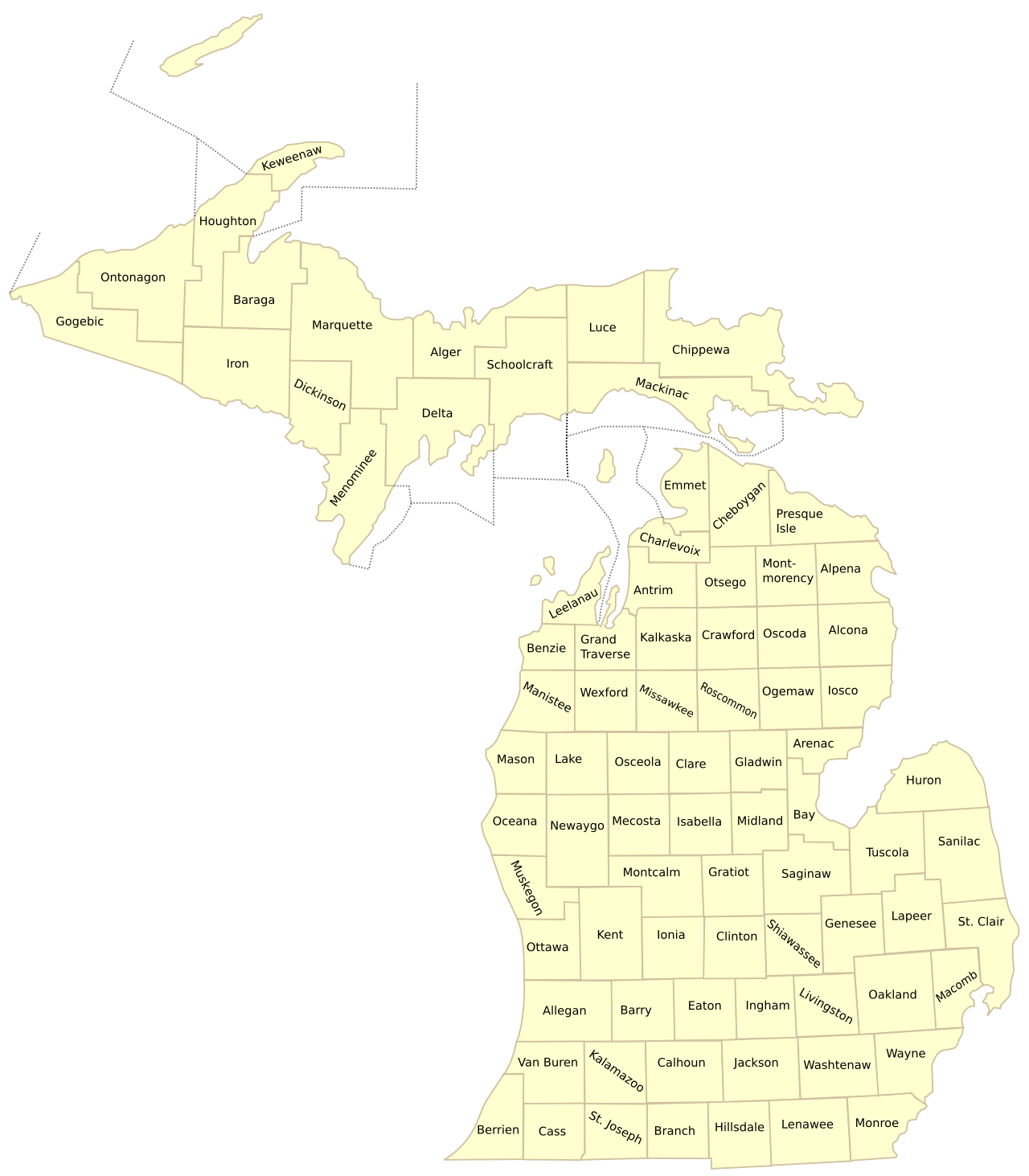
Monroe County Map Michigan: Official Cartographic Overview
When studying the spatial orientation and boundary framework of Monroe County, several critical geographic dimensions define its regional footprint:
📊 Geographic & Administrative Profile: Monroe County
Incorporated Cities, Villages & Civil Townships in Monroe County
Monroe County is governed through a balanced framework of incorporated municipalities and civil townships established under the Michigan Constitution. Each local entity maintains defined local zoning, municipal emergency services, and community school districts:
Cities & Villages in Monroe County:
Civil Townships in Monroe County:
Major Highway Networks & Transportation Corridors
Efficient movement across Monroe County is facilitated by high-capacity federal interstates, U.S. highways, and key state trunklines maintained by the Michigan Department of Transportation (MDOT). Key arterial roadways include:
- Interstate 75 (I-75): Primary north-south corridor connecting Detroit and Toledo, traversing Monroe, Frenchtown, and Erie.
- US Highway 23 (US-23): Western border arterial carrying major commuter freight between Ann Arbor, Dundee, and Ohio.
- US Highway 24 (Telegraph Road): Historic arterial linking Flat Rock, Monroe, and Toledo, heavily used for regional commerce.
- Interstate 275 (I-275): Northern Monroe connector providing direct western bypass routes around Detroit Metro Airport (DTW).
- M-50 & M-125: State trunklines connecting Monroe westward to Dundee and Dundee to Cabela’s regional retail corridor.
Prominent Landmarks, State Parks & Points of Interest
From protected coastal waters to cultural historic sites, Monroe County offers exceptional public spaces and educational landmarks:
- River Raisin National Battlefield Park: Historic War of 1812 battlefield preserving the site of the Battle of Frenchtown.
- Sterling State Park: The only Michigan state park situated directly on Lake Erie, featuring over a mile of sandy beach and boat launches.
- Fermi 2 Nuclear Generating Station: Major regional energy generation landmark located on the shore of Lake Erie in Frenchtown Township.
- Historic Downtown Monroe & River Raisin: Architectural heritage district along the River Raisin featuring historic civic courthouses and parks.
📥 Download High-Resolution Michigan Maps & Tools
Access official statewide cartographic references, printable labeled county maps, and comprehensive municipal directories:
Frequently Asked Questions (Monroe County Map Guide)
What is the county seat of Monroe County, Michigan?
The county seat of Monroe County is the City of Monroe, located on the River Raisin near the western shore of Lake Erie.
What major highways pass through Monroe County?
Monroe County is crossed by Interstate 75 (I-75), US Highway 23 (US-23), US Highway 24 (Telegraph Road), Interstate 275 (I-275), and State Route M-50.
How many townships are in Monroe County?
Monroe County contains 15 civil townships: Ash, Bedford, Berlin, Dundee, Erie, Exeter, Frenchtown, Ida, LaSalle, London, Milan, Monroe, Raisinville, Summerfield, and Whiteford.
Where can I download a printable map of Monroe County?
You can download high-resolution printable PDF and PNG maps directly from this page using the instant download button below.
Comprehensive Directory of Monroe County Municipalities & Townships
Monroe County (pop. ~155,000) anchors the extreme southeastern corner of Michigan along the western shore of Lake Erie, encompassing 15 civil townships, one city, and three incorporated villages across 551 square miles:
- City of Monroe: The historic county seat and sole incorporated city (pop. ~20,500), situated at the mouth of the River Raisin along Lake Erie. Known historically as Frenchtown, Monroe is celebrated for the River Raisin National Battlefield Park, the world headquarters of La-Z-Boy Inc., the historic Monroe County Courthouse, and the Port of Monroe—Michigan’s only cargo port on Lake Erie.
- Bedford Township: The most populous township in the county (pop. ~31,500), situated along the southern border directly adjacent to Toledo, Ohio. An affluent residential bedroom community encompassing Temperance, Lambertville, and Samaria, served by the highly ranked Bedford Public Schools district.
- Frenchtown Charter Township: Bordering the City of Monroe to the north and east (pop. ~21,000), encompassing extensive Lake Erie shoreline, Sterling State Park, the Fermi 2 Nuclear Power Plant operated by DTE Energy, and major retail centers along North Monroe Street (M-125).
- Berlin Charter Township: Located in northeastern Monroe County (pop. ~9,500), home to the historic incorporated Village of Estral Beach along Lake Erie. Traversed by I-75 and the Huron River delta, Berlin balances coastal marshes with heavy agricultural row-crop farming.
- Dundee Township & Village of Dundee: Situated in western Monroe County along the River Raisin and US-23 (pop. ~8,500). Famous for the massive 225,000-square-foot Cabela’s outdoor superstore (one of Michigan’s top tourist destinations), Dundee Automotive Engine Plant (Stellantis), and historic mill architecture.
- Milan Township & City of Milan: Located in northern Monroe County along US-23 and the Saline River, sharing municipal boundaries with Washtenaw County. Home to the Milan Dragway and historic agricultural homesteads.
- Ash, Exeter, London & Raisinville Townships: Covering the central and northern rural expanses of the county, characterized by fertile lacustrine clay soils producing high yields of corn, soybeans, winter wheat, and commercial sod farming.
- Ida, Summerfield, Whiteford & LaSalle Townships: Spanning the southwestern agricultural plain along the Ohio border, centered on tight-knit rural communities like Ida, Petersburg, Ottawa Lake, and LaSalle, featuring strong 4-H traditions and independent school systems.
Industrial Power, Maritime Logistics & Energy Generation
Monroe County functions as a critical energy production and intermodal trade conduit for the Great Lakes region. The Port of Monroe, situated on Lake Erie, is a modern multimodal deepwater port handling bulk cargo, heavy project freight, and wind turbine components, served by Norfolk Southern and Canadian National rail lines. Energy generation is anchored by the Enrico Fermi Nuclear Generating Station (Fermi 2) in Frenchtown Township, a 1,200-megawatt boiling water reactor supplying carbon-free electricity to over one million homes across Southeast Michigan. The county is also traversed by three major interstate freight arteries: I-75, connecting Detroit with Toledo and the southern US; I-275, providing an expressway bypass toward Detroit Metro Airport and western suburbs; and US-23, linking Ann Arbor with northern Ohio.
County Health, Hospital Infrastructure & Public Safety
Healthcare services in Monroe County are anchored by ProMedica Monroe Regional Hospital, a 160-bed full-service community hospital in the City of Monroe providing 24/7 emergency medicine, an accredited chest pain center, advanced robotic surgical suites, and comprehensive oncology care. Outlying southern townships enjoy direct ambulance transit access to tertiary medical centers in nearby Toledo, including ProMedica Toledo Hospital and the University of Toledo Medical Center. The Monroe County Health Department operates comprehensive community clinics, childhood immunization programs, and rigorous environmental health water quality testing for Lake Erie beaches and private rural water wells.
Public Education, Intermediate School Districts & Higher Education
The Monroe County Intermediate School District (MCISD) coordinates specialized educational services, special education programs, and career technical training for nine public school districts across the county, operating the Monroe County Educational Center and the Career Technology Center. Major local districts include Bedford Public Schools, Monroe Public Schools, Dundee Community Schools, and Jefferson Schools. Higher education is anchored by Monroe County Community College (MCCC), a comprehensive 210-acre campus in Raisinville Township enrolling over 3,000 students in advanced applied technology, nursing, welding, and renewable energy programs.
Historical War of 1812 Heritage & River Raisin National Battlefield
Monroe County holds profound significance in early American military history. Originally settled by French-Canadian habitants in 1784 and named Frenchtown, the area was the site of the catastrophic Battle of Frenchtown (Battle of the River Raisin) in January 1813 during the War of 1812. The defeat of American forces and subsequent massacre of wounded Kentucky militia prisoners birthed the legendary national rallying cry "Remember the Raisin!" which propelled American forces to victory at the Battle of the Thames. Today, the battlefield is permanently preserved as the River Raisin National Battlefield Park, the only National Battlefield Park in Michigan and the primary War of 1812 battlefield unit in the National Park System.
Lake Erie Coastal Ecology, Sterling State Park & The Walleye Capital
Monroe County commands Michigan’s entire 26-mile mainland coastline along Lake Erie, giving rise to one of the most productive freshwater ecosystems and sports fisheries in North America. The western basin of Lake Erie is globally celebrated among tournament anglers as the "Walleye Capital of the World," supporting immense populations of walleye, yellow perch, smallmouth bass, and channel catfish:
Coastal Recreation & State Preserves:
- Sterling State Park (Frenchtown Township): Michigan’s only state park located directly on Lake Erie. Spanning 1,300 acres, Sterling State Park features over one mile of sandy beach, modern full-hookup campsites, extensive coastal wetland lagoons, and a six-lane public boat launch accommodating hundreds of fishing vessels daily during peak spring walleye runs.
- Pointe Mouillee State Game Area (Berlin Township): Encompassing over 4,000 acres at the mouth of the Huron River on Lake Erie, Pointe Mouillee is one of the largest freshwater marsh restoration projects in the world, managed by the Michigan DNR and the U.S. Army Corps of Engineers as a world-class staging sanctuary for migrating waterfowl, shorebirds, and wetland raptors.
- River Raisin Water Trail: Flowing through Dundee and Monroe into Lake Erie, the River Raisin provides scenic kayaking and canoeing routes, historic millpond portages, and prime smallmouth bass fly fishing.
Fertile Lacustrine Soils & Agricultural Production:
Formed on the ancient glacial lakebed of ancestral Lake Erie, Monroe County’s deep, lacustrine clay and silty loam soils are among the most fertile in the Midwest. Maintained by an extensive network of legal county drainage districts overseen by the Monroe County Drain Commissioner, county farmers cultivate over 200,000 acres of row crops, leading the state in soybean and winter wheat yield per acre, alongside commercial turf sod nurseries and specialty market greenhouses.
County Road Network & Winter Highway Maintenance Protocols
The Monroe County Road Commission (MCRC) maintains over 1,400 miles of public roads and 150 bridges across 15 townships. Operating district garages in Monroe, Maybee, and Temperance, the MCRC deploys a modernized fleet of tandem-axle plow trucks equipped with automated ground-speed salt spreaders and liquid calcium chloride pre-wetting systems. Winter maintenance teams focus on critical interstate feeder routes like Telegraph Road (US-24), Dixie Highway, Lewis Avenue, and Secor Road, ensuring uninterrupted commercial transit between Detroit auto plants and Toledo supply terminals.
Courthouse Architecture, Historical Archives & Custer Heritage
Constructed in 1939 from Indiana limestone with streamlined Classical Revival architecture, the Monroe County Courthouse stands on historic Washington Street in downtown Monroe. The courthouse complex houses the 38th Circuit Court and county administrative archives dating back to 1817. Downtown Monroe also features the historic boyhood home and equestrian statue of General George Armstrong Custer, who spent his youth in Frenchtown prior to attending West Point and commanding Michigan cavalry brigades during the American Civil War.
Monroe County Civil Township Geographic Profiles:
- Ash Township (T5S, R9E): Spanning 35.8 square miles (pop. ~5,500), encompassing the historic Village of Carleton. Known for rich agricultural soils and direct CSX and Canadian National rail logistics.
- Erie Township (T8S, R8E): Anchoring the southern Lake Erie coast along the Ohio border (pop. ~4,500), home to the historic unincorporated community of Erie, Morin Point, and expansive coastal wetland marshes.
- Exeter Township (T5S, R8E): A rural agricultural sanctuary (pop. ~3,900) centered on Scofield, maintaining low-density zoning and productive row-crop farms.
- Ida Township (T7S, R7E): Covering 36.1 square miles (pop. ~4,900), celebrated across Southeast Michigan for its annual "Christmas in Ida" festival and parade. Served by Ida Public Schools.
- LaSalle Township (T7S, R8E): Located between Monroe and Toledo along Lake Erie (pop. ~4,800), featuring direct access via I-75 Exit 9 and scenic lakefront estates.
- London Township (T5S, R7E): Situated along the Washtenaw County border (pop. ~3,000), characterized by forested woodlots and oak openings.
- Raisinville Township (T6S, R7E): Traversed by the River Raisin (pop. ~5,800), home to Monroe County Community College and historic 19th-century papermill settlement sites.
- Summerfield Township (T7S, R6E): Anchoring southwestern Monroe County (pop. ~3,200), centered around the historic incorporated City of Petersburg along the River Raisin.
- Whiteford Township (T8S, R6E): Situated on the Ohio border directly adjacent to Sylvania, Ohio (pop. ~4,600), known for high agricultural crop yields and the Whiteford Agricultural School District.
Key Public Guidelines: Monroe County Land Records & Water Access:
Where can visitors launch large trailered boats into Lake Erie in Monroe County? Public boat launches capable of handling deep-draft fishing vessels and pleasure cruisers are located at Sterling State Park in Frenchtown Township (six paved launch lanes with extensive parking), Bolles Harbor in Monroe Township (operated by the DNR along the LaPlaisance Creek channel), and the mouth of the Huron River at Pointe Mouillee.
How can property owners search Monroe County property tax maps and assessments? Property records are publicly accessible through the Monroe County Equalization GIS Viewer. Users can search by property address, parcel identification number (PIN), or owner name to retrieve legal boundary descriptions, taxable values, and recorded plat maps.
Additionally, the Monroe County Business Development Corporation (BDC) coordinates regional economic expansion initiatives with the Detroit Regional Partnership and the Toledo Regional Chamber of Commerce, promoting advanced logistics warehousing, tier-one automotive stamping, and clean energy investments across the county’s major rail-served industrial parks.