
Explore our comprehensive St. Clair County Map guide, providing an authoritative cartographic and municipal overview of Michigan’s eastern maritime gateway and international border nexus. Situated along the southern shores of Lake Huron, the deepwater navigation channel of the St. Clair River, and the northern waters of Anchor Bay (Lake St. Clair), St. Clair County encompasses 836.5 square miles of jurisdictional territory, including 23 civil townships, six historic waterfront cities, the bustling international crossing at Port Huron, and the ecologically renowned St. Clair River Flats (the largest freshwater delta in North America). Whether you are coordinating commercial freight logistics across the Blue Water Bridge into Ontario, Canada, researching township property lines, locating public boat launches along Lake Huron, or investigating historical land records, this comprehensive guide delivers verified spatial, demographic, and civic data.
As the eastern anchor of the I-69 International Trade Corridor and the northern terminus of the I-94 freeway, St. Clair County links the industrial centers of the Midwestern United States directly to Canadian global supply chains. Every dataset on this page has been cross-referenced against the State of Michigan Center for Geographic Information (CGI), the United States Census Bureau TIGER/Line spatial database, and the official Michigan county map cartographic framework.
1. Official St. Clair County Map Gallery & Locator
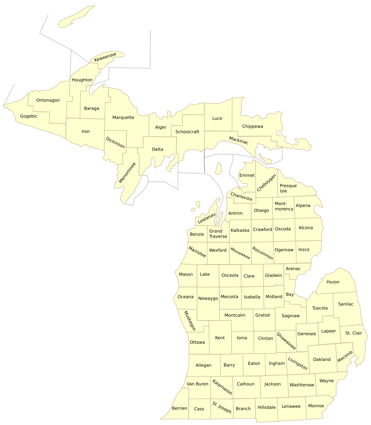
Below is the authentic United States Census Bureau and State GIS locator map depicting St. Clair County highlighted within Michigan’s Thumb and eastern border region:
2. St. Clair County Geographic & Civic Profile (FIPS 26147)
This master administrative summary outlines the primary civic, demographic, and territorial benchmarks for St. Clair County, Michigan:
| Administrative Benchmark | Verified Value & Data Point | Cartographic & Legal Context |
|---|---|---|
| State & Region | Michigan (Thumb / Blue Water Region) | Part of the Detroit-Warren-Ann Arbor CSA |
| County Seat | City of Port Huron | County Courthouse located at 201 McMorran Blvd. |
| Federal FIPS Code | 26147 | US Census Bureau spatial identifier |
| Date Organized | September 10, 1820 | Named in honor of General Arthur St. Clair, 1st Governor of Northwest Territory |
| Total Area | 836.5 square miles | Land Area: 721.2 sq mi | Water Area: 115.3 sq mi |
| Population (2020 Census) | 160,383 residents | Population Density: ~222.4 persons per sq mi |
| Largest Municipality | City of Port Huron (28,983 residents) | Followed by Marysville (9,997) and Fort Gratiot Twp (11,242) |
| International Border | Blue Water Bridge (to Point Edward / Sarnia, ON) | Second busiest commercial truck border crossing on the US-Canada frontier |
| Primary Water Bodies | Lake Huron, St. Clair River, Black River, Anchor Bay | St. Clair Flats delta includes Harsens Island and Dickinson Island |
3. Municipal Directory: Cities, Villages & Maritime Communities
St. Clair County features seven incorporated cities, two general-law villages, and numerous historic waterfront communities linked by the St. Clair River and Lake Huron coastlines:
A. The City of Port Huron (The Maritime & International Hub)
Serving as the county seat and the commercial heart of the Blue Water Area, the City of Port Huron (population 28,983) is situated at the exact point where the waters of Lake Huron narrow to form the fast-flowing St. Clair River. Celebrated as the boyhood home of inventor Thomas Edison, Port Huron is a historic center of Great Lakes commerce, shipbuilding, and international diplomacy. Key civic and cartographic landmarks include:
- The Blue Water Bridge: A twin-span international suspension and continuous truss bridge carrying Interstate 94 and Interstate 69 across the St. Clair River, directly connecting Port Huron to Point Edward and Sarnia, Ontario. The bridge accommodates over 4.5 million passenger vehicles and commercial transport trucks annually.
- Fort Gratiot Lighthouse: Established in 1825 and rebuilt in 1829, this historic 82-foot white brick tower is the oldest operating lighthouse in the State of Michigan, guarding the hazardous entrance from Lake Huron into the St. Clair River.
- The Black River Canal & Boardwalk: A pedestrian and recreational boat corridor winding through downtown Port Huron, featuring the Great Lakes Maritime Center, the Huron Lightship museum (the last operating lightship on the Great Lakes), and the annual Port Huron-to-Mackinac Island sailboat race starting line.
- St. Clair County Community College (SC4): Located in downtown Port Huron, SC4 serves over 4,000 students, anchoring the cultural and academic landscape of the Thumb region.
B. Waterfront & Inland Cities
The remaining incorporated cities in St. Clair County each feature distinct industrial, maritime, and historic roles:
- Marysville (population 9,997): Situated immediately south of Port Huron along the St. Clair River, Marysville is an industrial center historically known for the Wills Sainte Claire automobile and modern automotive tooling, chemical manufacturing, and the Marysville Riverfront Park boardwalk.
- St. Clair (population 5,464): Renowned for its Victorian charm, St. Clair boasts the world’s longest freshwater boardwalk (Palmer Park Boardwalk), stretching over 1,500 continuous feet along the St. Clair River, providing an international front-row seat to passing 1,000-foot Great Lakes freighters and ocean-going “salties.”
- Marine City (population 4,079): Located at the junction of the St. Clair River and the Belle River, Marine City was historically known as the “Shipbuilding Capital of the Great Lakes,” producing hundreds of wooden steamships in the 19th century. Today, it features live theaters, boutique shops, antique districts, and vehicle ferry service across the international border to Sombra, Ontario via the Bluewater Ferry.
- Algonac (population 4,196): Celebrated as the “Venice of Michigan” due to its network of interior residential canals, Algonac is the historic birthplace of Chris-Craft mahogany powerboats (founded by Christopher Columbus Smith in 1874). The city serves as the mainland ferry gateway to Harsens Island and the St. Clair Flats wildlife delta.
- Yale (population 1,903): Situated in north-central St. Clair County along the Mill Creek valley, Yale functions as an agricultural center, famously known for the C. Roy Inc. meat processing plant and the annual Yale Bologna Festival.
- Richmond (Macomb / St. Clair County border): While the primary municipal core of Richmond lies in northern Macomb County, eastern residential and commercial subdivisions extend across Division Road into Columbus Township in St. Clair County.
C. Incorporated Villages & Unincorporated Island Communities
- Capac (Mussey Township): An agricultural and industrial village situated along the historic M-21 rail corridor in western St. Clair County, supporting automotive stamping and manufacturing.
- Emmett (Emmett Township): A pastoral village located along M-19 just north of I-69, maintaining strong agricultural roots and family-owned enterprises.
- Harsens Island (Clay Township): Located within the St. Clair River delta, Harsens Island is an idyllic island community accessible exclusively via the Champion’s Auto Ferry from Algonac. It is home to historic canal cottages, the Tashmoo Park historic grounds, and premier duck hunting and muskie fishing waters.
4. Exhaustive Guide to St. Clair County’s 23 Civil Townships
St. Clair County is partitioned into 23 civil townships, each administering local property assessing, zoning, fire protection, and election precincts across the county’s 721 square miles of land:
| Township Name | Population (2020) | Land Area (sq mi) | Key Communities & Spatial Landmarks |
|---|---|---|---|
| Berlin Township | 3,162 | 37.2 | Allenton hamlet, Belle River headwaters, agricultural acreage bordering Lapeer Co. |
| Brockway Township | 1,957 | 33.4 | Surrounds the City of Yale; Mill Creek agricultural basin. |
| Burtchville Township | 4,079 | 15.1 | Lake Huron shoreline, Burtchville Township Park, residential lakefront cottages along M-25. |
| Casco Township | 4,048 | 37.0 | I-94 corridor, extensive greenhouse agriculture, border with Macomb County. |
| China Township | 3,509 | 34.2 | Belle River meandering valley, DTE energy transmission corridors, rural residential estates. |
| Clay Township | 8,446 | 82.4 | Encompasses Harsens Island, Dickinson Island, St. Clair Flats, and waterfront mainland. |
| Clyde Township | 5,523 | 35.8 | Black River county parklands, Abbotsford hamlet, rolling wooded suburban acreage. |
| Columbus Township | 4,112 | 37.3 | Borders the City of Richmond, Belle River crossing, pastoral estate subdivisions. |
| Cottrellville Township | 3,406 | 21.8 | Surrounds Marine City; St. Clair River shoreline frontage along M-29. |
| East China Township | 3,704 | 5.9 | Prime St. Clair River deepwater frontage between Marysville and Marine City; East China Park. |
| Emmett Township | 2,430 | 35.6 | Village of Emmett, I-69 interchange, agricultural cattle and crop farms. |
| Fort Gratiot Charter Twp | 11,242 | 16.1 | Major regional commercial retail hub along 24th Ave (M-25); Lake Huron beaches. |
| Grant Township | 1,897 | 29.8 | Jeddo hamlet, Black River state game habitats, quiet northern rural landscape. |
| Greenwood Township | 1,476 | 35.9 | Fargo hamlet, agricultural drainage canals, rural family farms. |
| Ira Township | 4,951 | 21.6 | Fair Haven community, Anchor Bay (Lake St. Clair) frontage, premier public boating ramps. |
| Kenockee Township | 2,423 | 35.7 | Avoca hamlet, historic Avoca Trestle bridge on the Bridge to Bay Trail, Mill Creek basin. |
| Kimball Township | 9,609 | 37.5 | Sparlingville, St. Clair County International Airport (PHN), I-94 and I-69 junction. |
| Lynn Township | 1,189 | 35.8 | Northwestern corner of county bordering Sanilac and Lapeer counties; prime agricultural soils. |
| Mussey Township | 4,275 | 35.7 | Surrounds Village of Capac; active manufacturing and commercial agriculture. |
| Port Huron Township | 10,792 | 25.4 | Surrounds west and south Port Huron; Baker College campus, I-94 logistics terminals. |
| Riley Township | 3,186 | 35.9 | Riley Center hamlet, Belle River crossings, rural estate parcels. |
| St. Clair Township | 7,085 | 38.7 | Surrounds the City of St. Clair; Pine River meanders, suburban executive housing. |
| Wales Township | 3,214 | 36.7 | Goodells county park, St. Clair County Farm Museum, annual 4-H county youth fair. |
5. Transportation Grids, International Freight & Waterways
St. Clair County’s transportation infrastructure is recognized as one of the most critical international trade gateways in North America:
- The Blue Water Bridge (I-94 / I-69): Owned and operated jointly by the Michigan Department of Transportation (MDOT) and Canada’s Federal Bridge Corporation Limited, the twin spans cross the St. Clair River, linking the United States directly to Highway 402 in Ontario. The crossing processes over $40 billion in commercial cargo annually, serving as a lifeline for automotive component supply chains between Detroit and Toronto.
- Interstate 94 (I-94): Terminates at the Blue Water Bridge toll plaza in Port Huron, connecting St. Clair County directly southwest through Macomb and Wayne counties into Detroit, Chicago, and the national Interstate network.
- Interstate 69 (I-69): Also terminating at the Blue Water Bridge, I-69 provides continuous freeway transit west through Lapeer, Flint, Lansing, and south through Indiana to the Mexican border at Laredo, Texas.
- M-25 Highway (Lake Huron Scenic Route): Beginning at I-94 in Port Huron, M-25 hugs the Lake Huron shoreline northward through Fort Gratiot and Burtchville townships, continuing around the entire perimeter of Michigan’s Thumb region to Bay City.
- M-29 Highway (River Road): Follows the St. Clair River southward from Marysville through St. Clair, Marine City, and Algonac to Anchor Bay, designated as a Michigan Pure Waterway scenic corridor.
- The St. Clair River Deepwater Navigation Channel: Part of the Great Lakes-St. Lawrence Seaway, this 39-mile freshwater strait accommodates commercial freighters carrying iron ore from Lake Superior to steel mills in Lake Erie and the Atlantic Ocean.
- Rail Freight Corridors (Canadian National): The Paul M. Tellier Tunnel, opened in 1995 beneath the St. Clair River between Port Huron and Sarnia, is a world-class railway tunnel accommodating double-stack intermodal container railcars.
6. The St. Clair River Delta, Maritime Heritage & State Parks
St. Clair County is celebrated internationally for its unique freshwater delta formations and premier state recreational lands:
- The St. Clair Flats Delta: Formed where the St. Clair River splits into multiple channels (North Channel, Middle Channel, South Channel) before entering Lake St. Clair, the Flats constitute the largest freshwater delta in the Western Hemisphere. Encompassing over 20,000 acres of open water, wild celery beds, and coastal marshes, it is an internationally recognized staging area for migratory waterfowl and home to world-class smallmouth bass and muskellunge sport fisheries.
- Lakeport State Park: Located ten miles north of Port Huron in Burtchville Township along M-25, this 565-acre state park features over a mile of natural Lake Huron pebble-and-sand beaches, 250 modern campsites, and expansive day-use picnic facilities.
- The Bridge to Bay Trail: An expansive 54-mile planned non-motorized regional trail network traversing St. Clair County, connecting Lakeport State Park in the north along the riverfront to Algonac and New Baltimore in the south.
- Historic Fort Gratiot County Park: Features 800 feet of pristine Lake Huron beach frontage, a public swimming area, and universal beach accessibility mats for visitors of all mobility levels.
7. Industrial Manufacturing, Maritime Commerce & Agriculture
St. Clair County balances a deepwater maritime economy with advanced precision manufacturing, healthcare, and extensive specialty agriculture:
- Automotive, Plastics & Precision Tooling: The county is home to major manufacturing plants supplying the global automotive sector, including ZF Chassis Components, Magna International, SMR Automotive, and Domtar Paper (historic Port Huron paper mill).
- Energy Infrastructure: Historically home to massive base-load coal generation, the St. Clair River corridor is a central hub for clean energy, natural gas storage facilities in Casco and China townships, and major electrical transmission grids linking Ontario’s Hydro One with Michigan’s ITC transmission network.
- Specialty Agricultural Production: Beyond its industrial riverfront, western and northern St. Clair County townships produce premium soybeans, corn, sugar beets, and sod. The county is also renowned for commercial greenhouse nurseries and equestrian breeding facilities.
9. Comprehensive Profiles of St. Clair County’s Coastal & Agricultural Townships
Each of St. Clair County’s 23 civil townships possesses a rich geographic, economic, and administrative history that defines its spatial character:
1. Clay Township & The St. Clair Flats (T2N, R16E)
Covering an expansive 82.4 square miles of land and water in the southwestern corner of the county, Clay Township is one of Michigan’s most ecologically significant coastal communities. Home to Harsens Island, Dickinson Island, and the St. Clair Flats State Wildlife Area, the township manages an intricate network of canal channels, marinas, and residential stilt cottages. Accessible by the Champion’s Auto Ferry, Harsens Island is a world-renowned destination for waterfowl hunting, pleasure boating, and muskellunge angling. Mainland Clay Township borders Anchor Bay along M-29, offering public waterfront parks and active boat launch infrastructure. Local education is provided by the Algonac Community School District.
2. Fort Gratiot Charter Township (T7N, R17E)
Positioned immediately north of Port Huron along Lake Huron, Fort Gratiot Charter Township (11,242 residents) is the commercial retail center of the northern Thumb region. The 24th Avenue (M-25) commercial corridor features regional shopping malls, big-box retailers, multiplex theaters, and healthcare clinics. Beyond its commercial spine, Fort Gratiot offers pristine public beaches along Lake Huron, including Fort Gratiot County Park and the historic site of Fort Gratiot, established by the US Army in 1814 during the War of 1812. Students attend Port Huron Area School District.
3. Port Huron Township (T6N, R16E)
Surrounding the western and southern boundaries of the City of Port Huron, Port Huron Township (10,792 residents) serves as the primary multimodal logistics and industrial distribution center for eastern Michigan. Traversed by both I-94 and I-69, the township houses major trucking terminals, bonded customs warehouses, modern industrial parks, and the main campus of Baker College of Port Huron. The township also manages the scenic 100-acre Port Huron Township Memorial Park along the Black River. Children attend Port Huron Area School District.
4. Kimball Township (T6N, R16E)
Located southwest of Port Huron, Kimball Township (9,609 residents) combines residential suburban neighborhoods with strategic aviation infrastructure. The township is home to St. Clair County International Airport (PHN), an international port of entry featuring all-weather instrument runways capable of handling corporate jets and commercial air cargo. The township also encompasses the vibrant unincorporated community of Sparlingville and preserves extensive wooded greenways along the Pine River. Local students are served by Port Huron and Marysville school districts.
5. East China Township (T4N, R17E)
Stretching along 5.9 square miles of prime St. Clair River waterfront between Marysville and Marine City, East China Township (3,704 residents) boasts some of the most scenic riverfront residential estates in Michigan. The township is celebrated for East China Park, an expansive 81-acre municipal recreational complex offering illuminated walking trails, soccer pitches, and natural riverfront boardwalks where visitors observe commercial freighters from across the globe. Children attend the East China School District.
6. St. Clair Township (T5N, R16E)
Surrounding the City of St. Clair to the west, St. Clair Township (7,085 residents) features rolling countryside, equestrian farms, and luxury residential subdivisions developed along the meandering banks of the Pine River. Traversed by I-94 and historic King Road, the township offers convenient commuter access to Detroit while preserving its tranquil pastoral setting. Public education is provided by East China School District.
7. Burtchville Township (T8N, R17E)
Occupying the northeastern Lake Huron shoreline of the county, Burtchville Township (4,079 residents) is a picturesque lakeside haven. Characterized by sandy Lake Huron swimming beaches, residential summer cottages, and permanent lakefront estates along M-25 (Lakeshore Road), the township is home to Burtchville Township Park and Lakeport. Students attend the Port Huron Area School District.
8. Ira Township & Fair Haven (T3N, R15E)
Located in the southwestern coastal sector of the county along Anchor Bay, Ira Township (4,951 residents) surrounds the historic fishing and boating community of Fair Haven. The township features extensive coastal wetlands, full-service commercial marinas, waterfront dining, and public access boat launches facilitating summer walleye tournaments and winter ice fishing festivals. Families are served by the Anchor Bay School District.
10. Historical Cartography, The Treaty of Detroit & 1820 County Formation
The geographic boundaries of St. Clair County reflect more than two centuries of international diplomacy, military defense, and territorial settlement:
- Native American Settlement & The 1807 Treaty of Detroit: Long before European arrival, the St. Clair River valley was inhabited by the Ojibwe (Chippewa), Odawa, and Potawatomi nations of the Council of Three Fires, who utilized the waterway as a primary transit highway between Lake Huron and Lake Erie. In 1807, Territorial Governor William Hull negotiated the Treaty of Detroit, ceding southeastern Michigan land—including present-day St. Clair County—to the United States government.
- Military Defense & Fort Gratiot (1814): During the War of 1812, American military forces recognized the strategic vulnerability of the St. Clair River strait. In May 1814, Captain Charles Gratiot supervised the construction of Fort Gratiot at the mouth of Lake Huron to repel British naval gunboats from Canada. The fort remained an active US Army garrison until 1879.
- Territorial Organization (1820): On September 10, 1820, Territorial Governor Lewis Cass formally proclaimed the creation of St. Clair County, carving it out of expansive Macomb County territory. Port Huron was established as the permanent county seat in 1871 after a spirited civic rivalry with the City of St. Clair.
11. Public Safety, Homeland Security & School District Directory
Due to its shared international boundary with Canada, St. Clair County maintains a specialized public safety and homeland security framework:
- St. Clair County Central Dispatch (911): Headquartered in Port Huron, Central Dispatch coordinates communications for 22 fire departments, 8 municipal police departments, the St. Clair County Sheriff’s Office, and emergency medical services (Tri-Hospital EMS and Richmond-Lenox EMS).
- Homeland Security & International Border Enforcement: The county collaborates directly with federal agencies, including US Customs and Border Protection (CBP), US Border Patrol (Detroit Sector Headquarters), and the United States Coast Guard (Station Port Huron), which conducts search-and-rescue and icebreaking operations across the lower St. Clair River and southern Lake Huron.
- St. Clair County Regional Educational Service Agency (RESA): Coordinates educational technology, vocational training (St. Clair County Career Technical Center), and special education across seven public school districts: Algonac, Capac, East China, Marysville, Memphis, Port Huron Area, and Yale Public Schools.
8. Frequently Asked Questions (St. Clair County Map)
Review these verified answers to the most common geographical and administrative questions regarding St. Clair County, Michigan:
What is the county seat of St. Clair County, Michigan?
The county seat of St. Clair County is the City of Port Huron, where the St. Clair County Courthouse, Administration Building, and primary government departments are located.
What bridge connects Port Huron to Canada?
The Blue Water Bridge is the twin-span international bridge carrying Interstate 94 and Interstate 69 across the St. Clair River, connecting Port Huron, Michigan directly to Point Edward and Sarnia, Ontario, Canada.
What is the oldest operating lighthouse in Michigan?
The Fort Gratiot Lighthouse, built in 1829 in Port Huron at the entrance to the St. Clair River, is the oldest operating lighthouse in the State of Michigan and is preserved as a public historic park.
How many townships are located in St. Clair County?
St. Clair County comprises exactly 23 civil townships, ranging from densely populated commercial townships like Fort Gratiot and Port Huron to coastal and island townships like Clay and Burtchville.
Where can I view an interactive map of St. Clair County and all 83 Michigan counties?
You can explore all 83 Michigan counties with satellite imagery, zoom controls, and demographic data on our live interactive Michigan county map explorer, or download clean PDF study sheets on our printable Michigan county map hub.