
Download high-resolution, free printable Michigan county maps formatted specifically for standard home printers, commercial printing presses, K-12 classrooms, university lecture halls, GIS research, and professional territory planning. Whether you require a completely blank Michigan county outline for student geography quizzes, a clear black-and-white labeled reference map, or an authoritative administrative guide complete with county seats, road networks, and Federal Information Processing Standard (FIPS) codes, this comprehensive cartographic library delivers publication-grade vector and raster formats.
Every printable sheet in this collection has been calibrated against official Michigan county map boundary data from the United States Census Bureau TIGER/Line geographic files and the Michigan Center for Geographic Information (CGI). Unlike automated web screenshots that become pixelated and illegible when printed on physical paper, our downloadable layouts are optimized at 300 DPI (Dots Per Inch) with high-contrast vector borders to ensure crystal-clear line definition across standard US Letter (8.5 × 11 inches), Tabloid (11 × 17 inches), and architectural poster formats.
1. Quick-Download Cartographic Suite: Free Printable PDF & High-Res Formats
Select the exact map format suited to your project, classroom lesson, or business workflow below. All PDF documents are pre-formatted with 0.25-inch safe print margins and optimized for both monochrome laser printing and full-color inkjet reproduction:
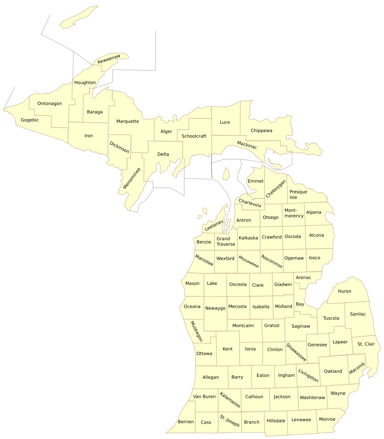
Option A: Official Labeled County Map
Best for: General geographic reference, home office reference, county boundary lookup, and research.
- Clear boundaries and names for all 83 Michigan counties.
- U.S. Census Bureau TIGER/Line verified cartographic baseline.
- Calibrated at 300 DPI for standard Letter (8.5″ × 11″) paper.
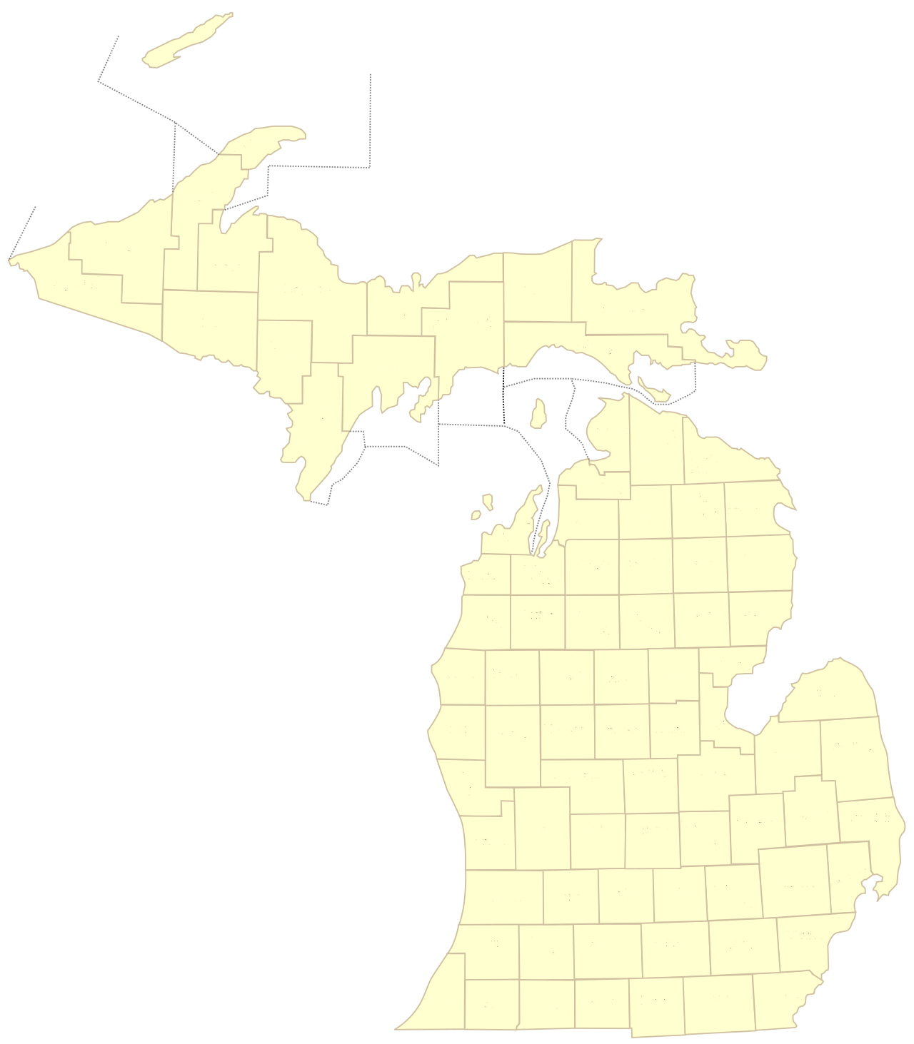
Option B: Blank County Outline Map
Best for: Classrooms, geography quizzes, student worksheets, thematic coloring, and sales territory planning.
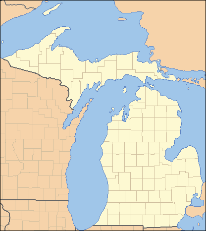
- High-contrast blank outline of all 83 county polygons.
- Student Name, Date, and Score header lines included on sheet.
- Classroom and homeschool certified for eco-friendly printing.
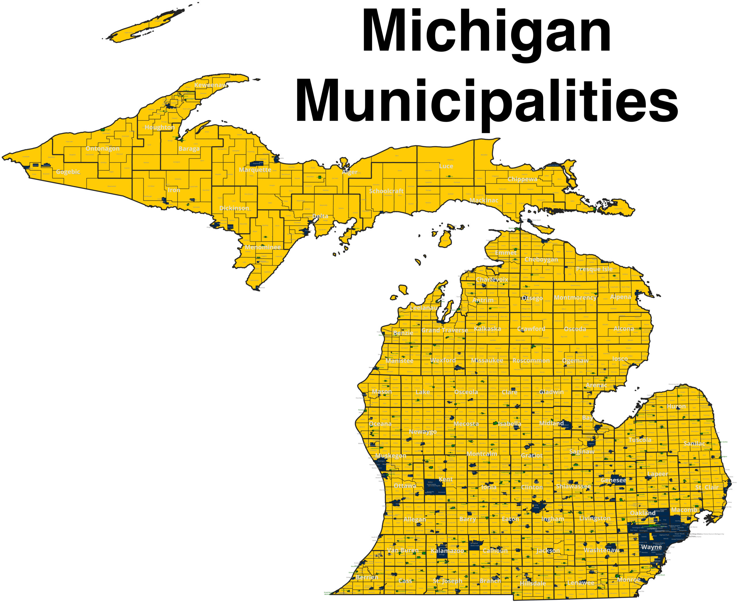
Option C: Municipalities & Cities Map
Best for: Cross-referencing cities, villages, and civil townships within their respective county jurisdictions.
- Official State GIS framework rendering illustrating 1,774 municipal divisions.
- High-resolution landscape PDF optimized for large-format plotters and desktop print.
- Clear boundaries between incorporated cities and general-law townships.
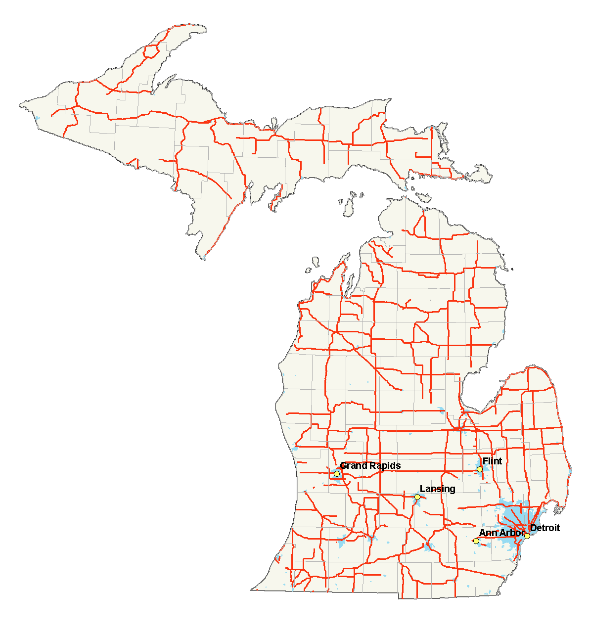
Option D: Highways & Transportation Network
Best for: Logistics coordinators, freight routing, commercial couriers, and road trip planning.
- Features major Interstate corridors (I-75, I-94, I-96, I-69) linking key county hubs.
- Highlights primary US Highways (US-131, US-23, US-31, US-2, US-41) and state trunklines.
- Clean vector cartography showing bridge crossings and peninsula connectors.
2. Visual Cartographic Gallery & Official Map Artifacts
Below are authentic, high-resolution previews of the four principal Michigan map editions. These maps represent genuine government framework data from the United States Geological Survey (USGS), the United States Census Bureau, and the State of Michigan Geographic Data Library:
3. Professional Printing & Hardware Calibration Guidelines
Printing detailed cartographic sheets presents unique technical challenges compared to printing standard text documents. A state map of Michigan must accurately depict 83 separate county polygons, intricate coastlines bordering four Great Lakes, and narrow islands such as Isle Royale in Lake Superior, Beaver Island in Lake Michigan, and Drummond Island in northern Lake Huron. To achieve sharp lines and pristine typography when sending our files to your home printer or commercial copy shop, follow these technical best practices:
A. Paper Sizing & Aspect Ratio Optimization
Because the State of Michigan spans approximately 456 miles from north to south and 386 miles from east to west—divided across two separate peninsulas—its overall bounding box is nearly square. Standard US Letter paper (8.5 × 11 inches) has a rectangular aspect ratio of 1:1.294. Printing Michigan on portrait orientation leaves empty margins on the left and right, while landscape orientation can compress the Upper Peninsula if scaling is not configured correctly.
- US Letter (8.5 × 11 inches) – Portrait Mode: Recommended for student study packets and three-ring binder inserts. Always select “Fit to Printable Area” or “Scale: 96%” in your printer dialog box. Never select “Fill Page”, as doing so will crop Isle Royale in Keweenaw County or the southern border with Ohio and Indiana.
- Tabloid / Ledger (11 × 17 inches) – Landscape Mode: The ideal format for corporate conference rooms, sales dispatch desks, and classroom wall displays. This format provides 2.3 times more surface area than Letter paper, allowing tiny text in densely populated Southeast Michigan (e.g., Wayne County, Oakland County, and Macomb County) to be read with 100% clarity from three feet away.
- Architectural C / D Posters (18 × 24 or 24 × 36 inches): When printing for municipal planning offices, legal exhibits, or library displays, utilize our 7,510 × 6,133 resolution PNG file. Outputting this file on an architectural plotter at 24 × 36 inches delivers a continuous-tone density of over 200 DPI, maintaining pin-sharp boundary lines for every civil township.
B. Resolution & DPI (Dots Per Inch) Science
In graphic design and GIS mapping, resolution determines whether thin boundary strokes appear solid or broken:
- 72 DPI (Web Resolution): Standard computer monitors display images between 72 and 144 DPI. If you right-click and print an ordinary web image, your printer attempts to convert those coarse pixels into physical ink dots, causing jagged stair-stepping (aliasing) along curved county borders like the Saginaw Bay coastline or the Leelanau Peninsula.
- 300 DPI (Commercial Print Standard): Our printable files are rendered natively at 300 DPI. At this density, 90,000 individual ink droplets occupy every square inch of paper. County border lines with a stroke weight of 0.75 points (approximately 0.01 inches) reproduce with laser precision.
- Printer Driver Settings: When accessing your print menu, navigate to Preferences / Quality and select “Best” or “High Quality (1200 DPI Rendering)” instead of “Draft” or “Normal”. This ensures the printer controller does not thin out delicate boundary vectors.
C. Paper Stock & Media Weight Selection
Standard 20-pound copy paper is adequate for single-use homework sheets, but it tends to warp (cockle) when colored with felt-tip markers or highlighters. For long-term durability, we recommend the following paper stocks:
- 24 lb or 28 lb Premium Bright White (98+ Brightness): The gold standard for business binders and student study guides. The enhanced opacity prevents show-through when students annotate both sides of the sheet.
- 65 lb or 80 lb White Cardstock: Essential for flashcards, laminated classroom sets, and desktop reference mats. Cardstock feeds smoothly through most modern laser and inkjet multi-function printers and can be laminated with 3-mil or 5-mil thermal pouches for wet-erase marker usage.
- Water-Resistant Synthetic Paper (Rite in the Rain / Tyvek): Ideal for agricultural extension agents, DNR conservation officers, forestry workers, and outdoor field researchers who must navigate Michigan county terrain in rainy or snowy conditions without paper degradation.
4. Educational Curriculums, Classroom Lessons & Printable Activities
Michigan’s geography is uniquely suited for K-12 social studies, earth science, and civics education because the state’s political subdivisions closely correlate with geographic landmarks, glacial topography, resource extraction history, and treaty settlements. Below are structured, ready-to-use lesson plans that educators can deploy immediately using our blank and labeled printable county maps:
Lesson Plan 1: Elementary Social Studies (Grades 3–5) – “The Two Peninsulas & Great Lakes Borders”
Educational Objective: Students will recognize Michigan’s unique two-peninsula structure, identify the bordering Great Lakes, and locate their home county relative to major geographic features.
- Materials Required: One copy of the Blank Michigan County Outline Map per student; colored pencils (blue, green, brown, orange).
- Step 1 (Bordering Waters): Have students shade Lake Superior to the north, Lake Michigan to the west, Lake Huron to the east, and Lake Erie to the southeast in light blue. Explain why Michigan has more freshwater coastline than any other US state.
- Step 2 (The Peninsulas): Instruct students to lightly color the 15 Upper Peninsula counties green and the 68 Lower Peninsula counties yellow. Have them draw a bold red line across the Straits of Mackinac to represent the Mackinac Bridge connecting St. Ignace in Mackinac County to Mackinaw City in Emmet County.
- Step 3 (Home County Discovery): Instruct students to find their home county, outline its boundary in black, and write the name of their county seat with a star icon.
Lesson Plan 2: Middle School Geography & History (Grades 6–8) – “The Cabinet Counties & The Toledo War”
Educational Objective: Students will investigate how Michigan acquired the Upper Peninsula and analyze the political naming conventions of Michigan counties created during the territorial administration of Lewis Cass.
- Historical Context: In 1829, the Territorial Council of Michigan named ten southern counties after President Andrew Jackson and nine members of his presidential cabinet. These became known as the “Cabinet Counties”: Ingham County (Samuel D. Ingham), Eaton County (John Eaton), Berrien County (John M. Berrien), Calhoun County (John C. Calhoun), Branch County (John Branch), Cass County (Lewis Cass), Jackson County (Andrew Jackson), Van Buren County (Martin Van Buren), and Livingston County (Edward Livingston).
- Student Assignment: Using the blank outline map, have students shade the Cabinet Counties in purple. Next, have students draw the historic “Harris Line” along the Michigan-Ohio border in Monroe County. In a 3-paragraph essay, have students explain how the bloodless 1835 Toledo War resulted in Michigan forfeiting the Toledo Strip to Ohio in exchange for congressional accession of the western three-quarters of the Upper Peninsula.
Lesson Plan 3: High School Civics & AP Human Geography (Grades 9–12) – “Gerrymandering, County Seats & Urban Density”
Educational Objective: Students will evaluate demographic distribution disparities across Michigan’s 83 counties and examine why county boundaries remain fixed while legislative districts are redrawn every decade.
- Demographic Comparison Activity: Using Census Bureau population data, students will calculate the population density (residents per square mile) of Michigan’s most populous county (Wayne County: ~1,760,000 residents across 612 sq mi = 2,875 people/sq mi) versus Michigan’s least populous county (Keweenaw County: ~2,100 residents across 540 land sq mi = ~3.9 people/sq mi).
- Choropleth Shading Exercise: Students will design a 5-tier choropleth shading key on their printable map (e.g., Tier 1: Under 25,000 residents; Tier 2: 25,000–75,000; Tier 3: 75,000–250,000; Tier 4: 250,000–750,000; Tier 5: Over 750,000). Students will visually discover the massive demographic concentration along the southern third of the Lower Peninsula compared to the northern counties.
5. The 10-Question Michigan County Geography Quiz & Answer Key
Print this assessment worksheet alongside the Blank Outline Map for classroom testing or personal knowledge evaluation:
- Question 1: How many total counties comprise the State of Michigan?
- Question 2: How many counties are located within the Upper Peninsula, and how many are located within the Lower Peninsula?
- Question 3: What is the largest county in Michigan by total surface area (including Great Lakes water territory)?
- Question 4: What is the largest county in Michigan by land area alone?
- Question 5: What is the smallest county in Michigan by total land area?
- Question 6: Name the only Michigan county whose boundary encompasses a National Park located entirely on an island in Lake Superior.
- Question 7: Which county serves as the seat of state government in Michigan, housing the State Capitol building in Lansing?
- Question 8: What county forms the distinctive “tip of the thumb” in the eastern Lower Peninsula?
- Question 9: What two counties are connected by the Mackinac Bridge?
- Question 10: Which Michigan county was named after the first Governor of the state, Stevens T. Mason?
Click to Reveal Quiz Answer Key & Geographic Explanations
- Answer: 83 counties.
- Answer: 15 counties are in the Upper Peninsula; 68 counties are in the Lower Peninsula.
- Answer: Keweenaw County is the largest by total area (5,966 sq mi, of which 5,425 sq mi is Lake Superior water).
- Answer: Marquette County in the Upper Peninsula is the largest by land area alone, encompassing 1,808 square miles of land.
- Answer: Benzie County in the northwestern Lower Peninsula is the smallest by land area, with only 321 square miles of land.
- Answer: Keweenaw County, which contains Isle Royale National Park.
- Answer: Ingham County (with the county seat located in Mason, and the state capital in Lansing).
- Answer: Huron County forms the northern tip of Michigan’s Thumb region.
- Answer: Mackinac County (Upper Peninsula) and Emmet County (Lower Peninsula).
- Answer: Mason County, located along Lake Michigan with Ludington as its county seat.
6. Master 83-County Printable Reference Table (FIPS, Seats & Areas)
This authoritative master reference table provides complete administrative data for all 83 Michigan counties. Use this table to verify FIPS codes, verify county seats, calculate population density, and cross-reference geographic boundaries against your printed maps:
| County Name | FIPS Code | County Seat | Land Area (sq mi) | Peninsula | Year Organized |
|---|---|---|---|---|---|
| Alcona County | 26001 | Harrisville | 674.5 | Lower | 1869 |
| Alger County | 26003 | Munising | 917.8 | Upper | 1885 |
| Allegan County | 26005 | Allegan | 825.2 | Lower | 1835 |
| Alpena County | 26007 | Alpena | 574.0 | Lower | 1857 |
| Antrim County | 26009 | Bellaire | 475.8 | Lower | 1863 |
| Arenac County | 26011 | Standish | 366.4 | Lower | 1883 |
| Baraga County | 26013 | L’Anse | 898.3 | Upper | 1875 |
| Barry County | 26015 | Hastings | 553.1 | Lower | 1839 |
| Bay County | 26017 | Bay City | 442.2 | Lower | 1857 |
| Benzie County | 26019 | Beulah | 321.3 | Lower | 1869 |
| Berrien County | 26021 | St. Joseph | 567.8 | Lower | 1831 |
| Branch County | 26023 | Coldwater | 506.4 | Lower | 1833 |
| Calhoun County | 26025 | Marshall | 708.6 | Lower | 1833 |
| Cass County | 26027 | Cassopolis | 490.1 | Lower | 1829 |
| Charlevoix County | 26029 | Charlevoix | 416.7 | Lower | 1869 |
| Cheboygan County | 26031 | Cheboygan | 715.3 | Lower | 1853 |
| Chippewa County | 26033 | Sault Ste. Marie | 1558.1 | Upper | 1826 |
| Clare County | 26035 | Harrison | 567.0 | Lower | 1871 |
| Clinton County | 26037 | St. Johns | 569.2 | Lower | 1839 |
| Crawford County | 26039 | Grayling | 556.1 | Lower | 1879 |
| Delta County | 26041 | Escanaba | 1171.1 | Upper | 1861 |
| Dickinson County | 26043 | Iron Mountain | 761.2 | Upper | 1891 |
| Eaton County | 26045 | Charlotte | 575.4 | Lower | 1837 |
| Emmet County | 26047 | Petoskey | 467.5 | Lower | 1853 |
| Genesee County | 26049 | Flint | 636.8 | Lower | 1836 |
| Gladwin County | 26051 | Gladwin | 502.2 | Lower | 1875 |
| Gogebic County | 26053 | Bessemer | 1101.9 | Upper | 1887 |
| Grand Traverse County | 26055 | Traverse City | 464.8 | Lower | 1851 |
| Gratiot County | 26057 | Ithaca | 569.7 | Lower | 1855 |
| Hillsdale County | 26059 | Hillsdale | 598.5 | Lower | 1835 |
| Houghton County | 26061 | Houghton | 1009.1 | Upper | 1845 |
| Huron County | 26063 | Bad Axe | 836.7 | Lower | 1859 |
| Ingham County | 26065 | Mason | 556.1 | Lower | 1838 |
| Ionia County | 26067 | Ionia | 571.5 | Lower | 1837 |
| Iosco County | 26069 | Tawas City | 549.1 | Lower | 1857 |
| Iron County | 26071 | Crystal Falls | 1166.0 | Upper | 1885 |
| Isabella County | 26073 | Mt. Pleasant | 572.7 | Lower | 1859 |
| Jackson County | 26075 | Jackson | 702.4 | Lower | 1832 |
| Kalamazoo County | 26077 | Kalamazoo | 561.7 | Lower | 1830 |
| Kalkaska County | 26079 | Kalkaska | 559.8 | Lower | 1871 |
| Kent County | 26081 | Grand Rapids | 847.1 | Lower | 1836 |
| Keweenaw County | 26083 | Eagle River | 540.3 | Upper | 1861 |
| Lake County | 26085 | Baldwin | 567.5 | Lower | 1871 |
| Lapeer County | 26087 | Lapeer | 643.1 | Lower | 1835 |
| Leelanau County | 26089 | Suttons Bay | 347.1 | Lower | 1863 |
| Lenawee County | 26091 | Adrian | 749.6 | Lower | 1826 |
| Livingston County | 26093 | Howell | 564.8 | Lower | 1836 |
| Luce County | 26095 | Newberry | 899.2 | Upper | 1887 |
| Mackinac County | 26097 | St. Ignace | 1021.6 | Upper | 1818 |
| Macomb County | 26099 | Mt. Clemens | 479.2 | Lower | 1818 |
| Manistee County | 26101 | Manistee | 542.4 | Lower | 1855 |
| Marquette County | 26103 | Marquette | 1808.4 | Upper | 1843 |
| Mason County | 26105 | Ludington | 495.2 | Lower | 1855 |
| Mecosta County | 26107 | Big Rapids | 555.7 | Lower | 1859 |
| Menominee County | 26109 | Menominee | 1043.8 | Upper | 1861 |
| Midland County | 26111 | Midland | 518.2 | Lower | 1850 |
| Missaukee County | 26113 | Lake City | 564.8 | Lower | 1871 |
| Monroe County | 26115 | Monroe | 551.0 | Lower | 1817 |
| Montcalm County | 26117 | Stanton | 707.3 | Lower | 1850 |
| Montmorency County | 26119 | Atlanta | 548.1 | Lower | 1881 |
| Muskegon County | 26121 | Muskegon | 499.0 | Lower | 1859 |
| Newaygo County | 26123 | White Cloud | 842.1 | Lower | 1851 |
| Oakland County | 26125 | Pontiac | 868.0 | Lower | 1819 |
| Oceana County | 26127 | Hart | 532.3 | Lower | 1855 |
| Ogemaw County | 26129 | West Branch | 563.4 | Lower | 1873 |
| Ontonagon County | 26131 | Ontonagon | 1311.2 | Upper | 1843 |
| Osceola County | 26133 | Reed City | 566.2 | Lower | 1869 |
| Oscoda County | 26135 | Mio | 565.4 | Lower | 1881 |
| Otsego County | 26137 | Gaylord | 514.8 | Lower | 1875 |
| Ottawa County | 26139 | Grand Haven | 563.2 | Lower | 1837 |
| Presque Isle County | 26141 | Rogers City | 658.7 | Lower | 1871 |
| Roscommon County | 26143 | Roscommon | 519.8 | Lower | 1875 |
| Saginaw County | 26145 | Saginaw | 800.1 | Lower | 1835 |
| Sanilac County | 26151 | Sandusky | 963.8 | Lower | 1848 |
| Schoolcraft County | 26153 | Manistique | 1177.3 | Upper | 1871 |
| Shiawassee County | 26155 | Corunna | 530.6 | Lower | 1837 |
| St. Clair County | 26147 | Port Huron | 721.2 | Lower | 1820 |
| St. Joseph County | 26149 | Centreville | 500.8 | Lower | 1829 |
| Tuscola County | 26157 | Caro | 806.4 | Lower | 1850 |
| Van Buren County | 26159 | Paw Paw | 607.3 | Lower | 1837 |
| Washtenaw County | 26161 | Ann Arbor | 706.0 | Lower | 1826 |
| Wayne County | 26163 | Detroit | 612.3 | Lower | 1796 |
| Wexford County | 26165 | Cadillac | 565.0 | Lower | 1869 |
7. Professional & Commercial Applications for Physical Maps
While digital mapping software like Google Maps and ArcGIS dominate modern computational workflows, physical, paper-based county maps provide mission-critical advantages in executive decision-making, emergency management, field operations, and legal administration:
A. Corporate Sales Territory Distribution & Franchise Mapping
Sales directors, pharmaceutical account managers, and logistics dispatchers routinely mount large-format 24 × 36 inch printed Michigan county maps on magnetic bulletin boards or foam core backing. County boundaries serve as the foundational building blocks for sales quotas and distributor territories because demographic data, retail sales tax rates, and liquor licensing jurisdictions are administered at the county level. By pin-flagging customer distribution across our blank outlines, executive teams can visually balance sales rep workload between dense urban corridors like Kent County (Grand Rapids) and expansive rural markets in the northern Lower Peninsula.
B. Emergency Management & First Responder Resiliency
During severe Midwestern weather events—such as ice storms that disable cellular towers in Mid-Michigan or blizzards that isolate Upper Peninsula highway corridors—first responders, Amateur Radio Emergency Service (ARES) teams, and County Sheriffs cannot rely exclusively on cloud-based mobile mapping. Laminated, physical county maps stored in fire command vehicles and municipal emergency operations centers (EOC) guarantee continuous operational awareness of mutual-aid boundary jurisdictions, hospital catchment zones, and county line evacuation routes regardless of power grid integrity.
C. Real Estate Due Diligence & Property Tax Lookups
In Michigan real estate transactions, county boundaries dictate millage rates, transfer taxes, and deed recordation requirements at the respective County Register of Deeds office. A printed boundary reference allows commercial brokers, title insurance examiners, and land surveyors to quickly resolve cross-border properties that span multiple county lines (such as municipal developments spanning Washtenaw County and Wayne County, or Livingston County and Oakland County) before executing deed filings.
9. Coordinate Systems, Projections & Survey Grid Frameworks
When transferring a curved spherical surface like planet Earth onto a flat two-dimensional printed sheet of paper, cartographers must apply mathematical map projections. Because Michigan extends across two distinct landmasses bordered by four Great Lakes, selecting the correct coordinate projection is vital for maintaining true angular shapes and proportional land boundaries:
- Michigan State Plane Coordinate System (SPCS): Established by the National Geodetic Survey (NGS) and codified in Michigan Public Act 9 of 1964 (amended by PA 154 of 1988), Michigan is divided into three distinct Lambert Conformal Conic projection zones:
- Zone 2111 (Michigan North): Covers all 15 counties of the Upper Peninsula, oriented along standard parallels at 45° 29′ N and 47° 05′ N. This zone minimizes distortion along the Lake Superior and Lake Michigan shorelines.
- Zone 2112 (Michigan Central): Encompasses the central Lower Peninsula from Mason and Oceana counties on the west coast across to Bay and Huron counties on Saginaw Bay, calibrated to standard parallels 44° 11′ N and 45° 42′ N.
- Zone 2113 (Michigan South): Encompasses the major economic and urban population corridor from Berrien County east through Washtenaw County, Wayne County, and Macomb County, pegged to standard parallels at 42° 06′ N and 43° 40′ N.
- Universal Transverse Mercator (UTM): The State of Michigan spans two federal UTM zones: UTM Zone 16 North (covering the western Upper Peninsula and western Lower Peninsula west of the 84th meridian west) and UTM Zone 17 North (covering eastern Michigan, Metro Detroit, and the Thumb). Our printable statewide overview maps utilize a customized Michigan Oblique Mercator (Hotine) projection to present both peninsulas in a balanced visual alignment without excessive northern tapering.
- The Public Land Survey System (PLSS): Unlike the original thirteen American colonies that utilized metes-and-bounds surveying based on trees and river bends, Michigan was surveyed under the Land Ordinance of 1785. Every Michigan county is subdivided into regular 6-mile by 6-mile civil or congressional survey townships, measured outward from the Michigan Meridian (84° 21′ 53″ W) and the Michigan Baseline (42° 25′ 28″ N). Understanding this 36-square-mile grid system allows land title examiners and property owners to cross-reference our printed county outlines directly against legal deed descriptions.
10. Eco-Friendly Printing: Ink Conservation & Toner Efficiency
For school districts, municipal clerks, and non-profit nature conservancies printing dozens or hundreds of Michigan county maps simultaneously, toner and ink consumption represents a significant budgetary consideration. Implementing these technical adjustments reduces printing costs by up to 65% while maintaining boundary readability:
- Selecting Monochrome Vector Over Raster Fill: Our Blank Outline Map utilizes a hairline vector stroke weight (0.75 pt) with zero raster pixel fill inside the 83 county polygons. When printed on a standard commercial laser multifunction printer (such as HP LaserJet or Xerox WorkCentre), each sheet consumes less than 4% total page toner coverage, allowing a single 5,000-page toner cartridge to output several thousand student worksheets without replacement.
- Draft / Eco-Mode Verification: While full-color photographic maps require “Best Quality” settings, our high-contrast black-and-white county outline prints cleanly even in “Toner Saver” or “Draft” printer modes. The high-contrast demarcation between white landmass and black border strokes ensures that county lines do not disappear or fade during economy printing cycles.
- Duplexing for Student Study Units: When assembling classroom geographic study packets, configure your printer driver to “Duplex / Print on Both Sides” (flipping on the long edge). Place the Labeled Reference Map on Side A for memorization and study, and the Blank Outline Map on Side B for testing and self-assessment, cutting paper consumption exactly in half.
8. Frequently Asked Questions (Printable Maps)
Review these verified answers to the most common questions regarding printing, downloading, and utilizing our Michigan county map collection:
Are these printable Michigan county maps free for commercial and educational use?
Yes. All printable maps provided on this page are licensed for unrestricted personal, educational K-12, university, and internal commercial use. Teachers may print unlimited copies for classroom quizzes and curriculum binders. Commercial enterprises may incorporate these outlines into internal business plans, dispatch logs, and territory presentations with no royalty fees.
What is the best way to print the map on standard 8.5 x 11 inch paper without cutting off the edges?
Open the downloaded image or PDF file in Adobe Acrobat Reader or your web browser’s native print viewer. In the print dialog settings under “Page Sizing & Handling”, select “Fit” or “Fit to Printable Area”. Ensure that the orientation is set to “Portrait”. This automatically scales the map to leave a standard 0.25-inch margin on all sides, ensuring that Isle Royale in Lake Superior and the southern border with Ohio remain fully visible.
How can I print a blank Michigan county map for a student test?
Download our Blank Michigan County Outline Map. This format removes all county names, city labels, highway markings, and extraneous text, leaving only the clean, bold borders of all 83 counties. It is specifically designed to be photocopied or printed on monochrome school laser copiers with zero grey background shading.
Which Michigan county is the largest in physical land area?
Marquette County in the Upper Peninsula is the largest county by land area, measuring 1,808.4 square miles. When factoring in Great Lakes water territory, however, Keweenaw County is the largest overall county, encompassing 5,966 total square miles (with 5,425 square miles consisting of Lake Superior open water).
Which Michigan county has the smallest land area?
Benzie County, located in the northwestern Lower Peninsula along Lake Michigan, is the smallest county by land area, measuring approximately 321.3 square miles.
Can I edit these maps in graphic software like Adobe Illustrator or Inkscape?
Yes. Our high-resolution PNG files can be imported as raster reference layers into vector drawing suites like Adobe Illustrator, Inkscape, or CorelDRAW. Because boundary lines are rendered with high contrast, you can easily use automated vector tracing (“Image Trace” or “Trace Bitmap”) to generate editable SVG path objects for individual counties.
How many counties are in the Upper Peninsula versus the Lower Peninsula?
Michigan comprises exactly 83 counties: 15 counties are located in the Upper Peninsula (covering approximately 29% of the state’s total land area), while 68 counties are located in the Lower Peninsula (housing over 96% of Michigan’s residential population).
Where can I explore an interactive version of the Michigan county map?
You can use our live, mobile-friendly interactive mapping tool directly on the Michigan county map homepage. The interactive explorer allows you to zoom into individual county borders, click for instant population and demographic data, and inspect dynamic satellite imagery overlays.