
Explore our detailed cartographic guide to Leelanau County, Michigan. Located in Northwest Lower Peninsula (The Little Finger), Leelanau County is centered around its county seat of Suttons Bay (historic Leland), encompassing 2,532 sq mi (6,560 km²) across thriving municipalities, scenic natural resources, and critical transportation networks.
Quick Facts & Geographical Overview of Leelanau County
| County Seat | Suttons Bay (historic Leland) | FIPS Code | 26089 |
| Estimated Population | 22,301 | Regional District | Northwest Lower Peninsula (The Little Finger) |
| Total Area | 2,532 sq mi (6,560 km²) | Land / Water Area | 347 sq mi (900 km²) land | 2,185 sq mi (5,660 km²) water |
Leelanau County Reference Map & Cartography
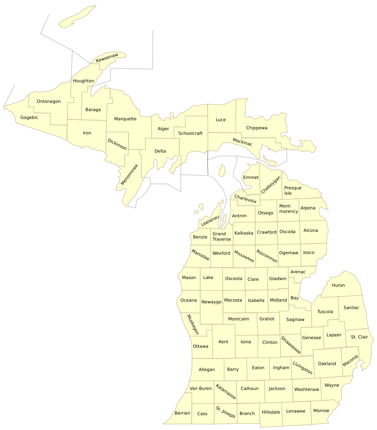
Below is the comprehensive cartographic overview of Leelanau County illustrating jurisdictional boundaries, highway corridors, and surrounding regional connections across Michigan.
Municipalities, Communities & Townships in Leelanau County
Villages: Suttons Bay, Northport, Empire
Unincorporated Communities: Leland (Fishtown), Glen Arbor, Cedar, Maple City, Omena, Lake Leelanau
Civil Townships (11): Bingham, Centerville, Cleveland, Elmwood, Empire, Glen Arbor, Kasson, Leelanau, Leland, Solon, Suttons Bay
Major Highways & Transportation Corridors
Leelanau County is served by a resilient network of state trunklines and arterial highways that connect residents and freight across Michigan:
- M-22: World-renowned scenic highway encircling the entire Leelanau Peninsula, passing coastal villages, dunes, and bays.
- M-72: Major east-west arterial connecting Traverse City directly to Empire and Sleeping Bear Dunes.
- M-109: Scenic loop traversing the Sleeping Bear Dunes Dune Climb, Glen Lake, and Pierce Stocking Scenic Drive.
- M-204: Cross-peninsula east-west connector linking Suttons Bay on Grand Traverse Bay to Leland on Lake Michigan.
Prominent Landmarks & Geographic Attractions
From pristine waterfront coastlines and national parks to historic civic districts, Leelanau County boasts distinct regional attractions:
- Sleeping Bear Dunes National Lakeshore: Iconic national park featuring massive 450-foot perched sand dunes overlooking Lake Michigan, voted ‘Most Beautiful Place in America’.
- Historic Fishtown in Leland: One of the last working 19th-century commercial fishing villages on the Great Lakes, featuring weathered shanties, smokehouses, and ferry docks.
- Grand Traverse Lighthouse: Historic 1858 lighthouse situated at the northern tip of the Leelanau Peninsula within Leelanau State Park.
- Leelanau Peninsula Wine Trail: Premier Midwestern viticultural destination featuring over 25 award-winning vineyards and tasting rooms across rolling hills.
Explore Related Michigan Map Resources
- List of Michigan Counties – Master alphabetical directory of all 83 counties.
- Michigan Counties by Population – Complete 1-to-83 demographic rankings and density data.
- Michigan Highway and County Map – Statewide Interstate and road corridor cartography.
- Printable Michigan County Maps – Free classroom and vector PDF downloads.
Frequently Asked Questions – Leelanau County Map
What is the county seat of Leelanau County?
The official county government seat is located in Suttons Bay Township, while the historic courthouse was historically located in Leland.
Is Sleeping Bear Dunes located in Leelanau County?
Yes, the majority of Sleeping Bear Dunes National Lakeshore—including the Dune Climb, Pierce Stocking Scenic Drive, and Glen Lake—is located within Leelanau County.
What major islands belong to Leelanau County?
North Manitou Island and South Manitou Island, located offshore in Lake Michigan, are politically part of Leland Township within Leelanau County.
Where can I download a printable Leelanau County map?
You can download high-resolution vector PDF maps directly from MichiganCountyMap.com using the instant download button on this page.
Comprehensive Directory of Leelanau County Municipalities & Townships
Leelanau County (pop. ~22,500) forms the "Little Finger" of the Michigan mitten, extending into Lake Michigan and Grand Traverse Bay. Encompassing 11 civil townships and three incorporated villages across 347 square miles of land area (and 2,185 square miles of water area), the county is a world-acclaimed eco-tourism, viticultural, and fruit-growing sanctuary:
- Leland Township & Village of Leland: Located on the western Lake Michigan coast (pop. ~2,100), where the Carp River empties into the lake from Lake Leelanau. Internationally famous for Fishtown, a preserved 19th-century commercial fishing village of weathered shanty docks, smokehouses, and active whitefish tugs (Janice Sue and Joy), alongside the Manitou Island Transit ferry dock to North and South Manitou Islands.
- Suttons Bay Township & Village of Suttons Bay: Situated on the protected eastern shore of Grand Traverse Bay (pop. ~3,000). The cultural and shopping hub of the county, featuring walkable art galleries, boutique shopping, Suttons Bay Marina, the historic Bay Theatre, and the administrative headquarters of the Grand Traverse Band of Ottawa and Chippewa Indians in Peshawbestown.
- Glen Arbor Township: Anchoring the western shoreline (pop. ~900), surrounded by Sleeping Bear Dunes National Lakeshore. Situated between Lake Michigan, Big Glen Lake, and Little Glen Lake, Glen Arbor is renowned for luxury vacation cottages, the crystal-clear waters of the Crystal River, and world-class hiking at the Dune Climb and Pierce Stocking Scenic Drive.
- Northport & Leelanau Township: Occupying the northernmost tip of the peninsula (pop. ~1,500), centered around the historic village of Northport and Northport Point. Home to Grand Traverse Lighthouse (built 1858 at the tip of the peninsula in Leelanau State Park), Peterson Park, and deepwater yacht marinas.
- Empire Township & Village of Empire: Situated on the southwestern coast (pop. ~1,200), housing the National Park Service Headquarters for Sleeping Bear Dunes. Celebrated for Empire Beach, the iconic Empire Bluffs trail offering panoramic vistas of Lake Michigan, and the annual Empire Asparagus Festival.
- Bingham Township: Positioned in central-eastern Leelanau County along Grand Traverse Bay (pop. ~2,600), encompassing Bingham and the southern reaches of Lake Leelanau, featuring rolling cherry orchards and the Leelanau Trail rail-trail.
- Centerville Township: Located in the geographic center of the peninsula (pop. ~1,300), encompassing the historic community of Schomberg and the eastern shores of South Lake Leelanau.
- Elmwood Charter Township: The most populous township in the county (pop. ~4,900), situated at the base of Grand Traverse Bay directly bordering Traverse City. Home to Greilickville, the Leelanau County Harbor, Cherry Bend road residential neighborhoods, and Discovery Pier.
- Kasson & Solon Townships: Covering the rural southern moraines of the county, characterized by hardwood woodlots, gravel moraines, and the winding Cedar River wetlands.
Sleeping Bear Dunes National Lakeshore & Lake Michigan Shoreline
Voted the "Most Beautiful Place in America" by viewers of ABC’s Good Morning America, Sleeping Bear Dunes National Lakeshore encompasses 71,000 acres spanning 35 miles of pristine Lake Michigan coastline, including North and South Manitou Islands. Established in 1970 and managed by the National Park Service, the park features monumental glacial sand dunes rising up to 450 feet above Lake Michigan, ghost forests, pristine beech-maple climax forests, and the historic Port Oneida Rural Historic District—the largest preserved historic agricultural landscape in the National Park System.
The Leelanau Peninsula AVA: Cool-Climate Wine & Tart Cherries
Designated in 1982, the Leelanau Peninsula American Viticultural Area (AVA) is Michigan’s oldest and most prestigious federally designated wine appellation. Surrounded entirely by water (Lake Michigan on the west, Grand Traverse Bay on the east), the peninsula benefits from an extended 150-day frost-free growing season. Over 25 estate wineries—including Mawby (celebrated sparkling wines), Black Star Farms, Chateau Fontaine, and 45 North Vineyard—cultivate world-class cool-climate vinifera grapes, particularly Riesling, Pinot Blanc, Chardonnay, Pinot Noir, and Cabernet Franc. Simultaneously, the county produces millions of pounds of Montmorency tart cherries annually, processed at local agricultural co-ops.
County Governance, Historic Courthouses & Road Commission
Leelanau County was originally organized in 1863, named by territorial ethnologist Henry Schoolcraft from a Native American word translated as "Delight of the Land." After historically alternating between Northport and Leland, the official county seat was relocated in 2008 to a centralized government campus in Suttons Bay Township. The Leelanau County Road Commission (LCRC) maintains over 600 miles of county roads. Operating maintenance garages in Suttons Bay and Maple City, LCRC deploys heavy plow units across scenic coastal highways like M-22, M-204, and M-109, ensuring safe travel through rigorous lake-effect snow squalls.
Indigenous Anishinaabe Sovereignty & Early Maritime History
The Leelanau Peninsula has been the ancestral homeland of the Anishinaabeg (specifically the Odawa and Ojibwe peoples) for thousands of years. Ceded to the federal government under the 1836 Treaty of Washington, tribal sovereignty endures today through the Grand Traverse Band of Ottawa and Chippewa Indians, a federally recognized sovereign tribal government headquartered in Peshawbestown on the Leelanau Peninsula. The tribe operates the Leelanau Sands Casino and Lodge, tribal healthcare centers, and environmental fisheries conservation initiatives along Grand Traverse Bay.
Granular Leelanau County Civil Township Geographic Profiles:
- Bingham Township (T29N, R11W): Covering 24.8 square miles along Grand Traverse Bay (pop. ~2,600), known for premier roadside fruit stands, cherry orchards, and the Leelanau Trail rail-trail.
- Centerville Township (T29N, R12W): Located in the geographic center of the peninsula (pop. ~1,300), encompassing historic agricultural settlements and the eastern shore of South Lake Leelanau.
- Cleveland Township (T29N, R13W): Nestled along the shores of Lime Lake and Little Traverse Lake (pop. ~1,100), offering peaceful woodland cottages and Sugar Loaf Mountain recreation.
- Elmwood Charter Township (T28N, R11W): Anchoring the southern boundary directly adjacent to Traverse City (pop. ~4,900), featuring Greilickville Harbor, commercial shopping, and luxury bayfront estates.
- Empire Township (T28N, R14W): Encompassing 42.6 square miles (pop. ~1,200), housing the National Park Service Visitor Center and world-famous Empire Bluffs trail.
- Glen Arbor Township (T29N, R14W): Situated between Big Glen Lake and Lake Michigan (pop. ~900), celebrated for Pierce Stocking Scenic Drive, the Dune Climb, and the Crystal River.
- Kasson Township (T28N, R13W): A productive agricultural moraine (pop. ~1,600) producing apples, cherries, and timber in southern Leelanau County.
- Leelanau Township (T31N & T32N, R11W): Crowning the northern tip (pop. ~1,500), encompassing Northport, Northport Point, and Grand Traverse Lighthouse in Leelanau State Park.
- Leland Township (T30N, R12W): Encompassing historic Fishtown and the Village of Leland (pop. ~2,100), where the Lake Leelanau dam flows into Lake Michigan.
- Solon Township (T28N, R12W): Situated around the historic timber hamlet of Cedar (pop. ~1,500), renowned for its annual Cedar Polka Festival and Polish culinary heritage.
- Suttons Bay Township (T30N, R11W): Encompassing the vibrant artistic Village of Suttons Bay (pop. ~3,000) and the Leelanau County Government Center.
North and South Manitou Islands: Wilderness Outposts:
Lying six to twelve miles offshore in Lake Michigan, South Manitou Island and North Manitou Island form an integral part of Leelanau County and Sleeping Bear Dunes National Lakeshore. In the 1840s, South Manitou’s deep natural crescent harbor served as a vital wood refueling station for Great Lakes steamships traveling between Chicago and Buffalo. Today, both islands are designated wilderness preserves accessible via ferry from Leland, featuring the historic 1871 South Manitou Lighthouse, giant virgin white cedar groves, perched sand dunes, and the grounded shipwreck of the Francisco Morazan.
The National Tart Cherry Capital & Agricultural Cooperatives:
Leelanau County produces more Montmorency tart cherries per square mile than any other county in the United States. Thanks to the lake-moderated coastal climate and gravelly glacial moraine slopes that allow cold spring air to drain downward away from blossoming fruit trees, county orchards yield up to 100 million pounds of tart cherries in peak harvest seasons. Agricultural processing centers in Suttons Bay and Northport flash-freeze cherries, bottle tart cherry juice concentrates, and dry cherries for global commercial bakery and culinary distribution.
The Fox Islands: Remote Lake Michigan Archipelago:
Situated approximately 17 miles northwest of Northport in open Lake Michigan lie South Fox Island and North Fox Island, both legally incorporated within Leelanau Township. South Fox Island spans 3,400 acres, featuring monumental freshwater sand dunes rising 300 feet above the lake and the historic 1867 South Fox Island Lighthouse tower. North Fox Island encompasses 820 acres, entirely preserved in the public trust as a state wildlife sanctuary featuring a public turf airstrip for backcountry aviation enthusiasts.
Leelanau County Road Commission Winter Protocols:
The Leelanau County Road Commission (LCRC) oversees maintenance for over 600 miles of county roads. Winding along high glacial moraines, scenic coastal trunklines like M-22, M-204, and M-109 require specialized winter clearing. LCRC deploys heavy tandem-axle plow trucks equipped with wing plows and calibrated liquid brine systems to keep steep coastal ridges safe during intense lake-effect snow squalls dropping off Lake Michigan and Grand Traverse Bay.
Key Public Guidelines: Leelanau County Fishtown & Dune Climb:
Is historic Fishtown in Leland open to the public year-round? Yes, the historic shanties, smokehouses, and river docks of Fishtown are open to visitors throughout the year. Operating commercial fishing tugs continue to land fresh Lake Michigan whitefish and lake trout daily, and visitors can purchase smoked fish, artisan cheeses, and nautical gifts.
How long does it take to climb the Sleeping Bear Dune Climb? Climbing the initial 110-foot sand wall takes approximately 10 to 15 minutes. For those hiking the strenuous 3.5-mile round-trip trail across rolling sand dunes to Lake Michigan, the hike takes between 2 to 3 hours.
Additionally, the Leelanau County Government Center in Suttons Bay Township houses the Leelanau County Sheriff’s Office, 911 Central Dispatch, and the Department of Emergency Management. Operating high-elevation VHF radio repeaters atop glacial moraines, the dispatch center coordinates emergency medical responders across all 11 townships and coordinates maritime emergency rescues with the U.S. Coast Guard Air Station Traverse City and local volunteer fire departments serving remote peninsula points and offshore islands.
Furthermore, the Leelanau Conservancy has permanently protected over 16,000 acres of sensitive coastal dunes, inland lake watersheds, working cherry orchards, and hardwood forests across the peninsula, establishing 28 public natural preserves and over 30 miles of hiking trails accessible to residents and seasonal visitors.
Additionally, the Leelanau County Planning Commission coordinates sustainable coastal development policies with tribal leaders and municipal zoning boards, balancing year-round residential housing needs with the protection of pristine inland lake water quality across Lake Leelanau and Glen Lake.
Moreover, the Leelanau Historical Society and Museum in Leland preserves an extensive collection of Great Lakes maritime artifacts, traditional Anishinaabe black ash basketry, and historic nineteenth-century fruit canning ledgers from pioneer peninsula farms.
Additionally, the Leelanau Peninsula Chamber of Commerce promotes sustainable coastal tourism, connecting travelers to boutique farm markets, heritage cider mills, and peaceful public beaches across Lake Michigan and Grand Traverse Bay.