
Explore our detailed cartographic guide to Chippewa County, Michigan. Located in Eastern Upper Peninsula (Straits, St. Marys River & Superior), Chippewa County is centered around its county seat of Sault Ste. Marie, encompassing 2,698 sq mi (6,990 km²) across thriving municipalities, scenic natural resources, and critical transportation networks.
Quick Facts & Geographical Overview of Chippewa County
| County Seat | Sault Ste. Marie | FIPS Code | 26033 |
| Estimated Population | 36,785 | Regional District | Eastern Upper Peninsula (Straits, St. Marys River & Superior) |
| Total Area | 2,698 sq mi (6,990 km²) | Land / Water Area | 1,561 sq mi (4,040 km²) land | 1,137 sq mi (2,950 km²) water |
Chippewa County Reference Map & Cartography
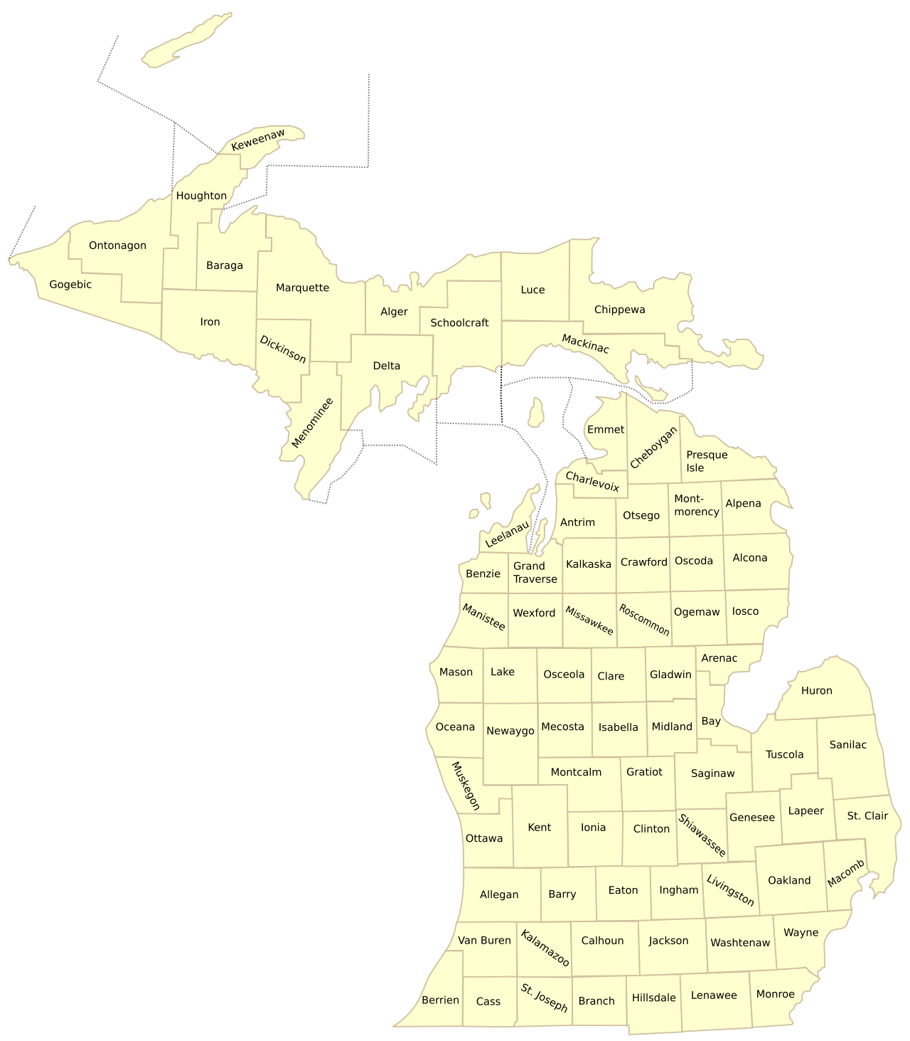
Below is the comprehensive cartographic overview of Chippewa County illustrating jurisdictional boundaries, highway corridors, and surrounding regional connections across Michigan.
Municipalities, Communities & Townships in Chippewa County
Incorporated Cities: Sault Ste. Marie
Villages: DeTour Village
Unincorporated Communities: Brimley, Pickford, Rudyard, Kincheloe, Trout Lake, Paradise, Barbeau, Strongs
Civil Townships (16): Bay Mills, Bruce, Chippewa, Dafter, DeTour, Drummond, Hulbert, Kinross, Pickford, Raber, Rudyard, Soo, Sugar Island, Superior, Trout Lake, Whitefish
Major Highways & Transportation Corridors
Chippewa County is served by a resilient network of state trunklines and arterial highways that connect residents and freight across Michigan:
- Interstate 75 (I-75): Northern terminus of the 1,786-mile interstate, concluding at the Sault Ste. Marie International Bridge to Canada.
- M-28: Primary Upper Peninsula east-west arterial originating near Sault Ste. Marie and spanning 290 miles across the U.P.
- M-123: Scenic circular loop highway providing direct access to Tahquamenon Falls State Park and Whitefish Point.
- M-134: Scenic Lake Huron coastal trunkline connecting I-75 to DeTour Village and the Drummond Island vehicle ferry.
Prominent Landmarks & Geographic Attractions
From pristine waterfront coastlines and national parks to historic civic districts, Chippewa County boasts distinct regional attractions:
- The World-Famous Soo Locks: One of the greatest engineering feats in maritime history, safely raising and lowering 1,000-foot Great Lakes freighters between Lake Superior and Lake Huron.
- Drummond Island: Michigan’s ‘Ultimate Playground’ spanning 249 square miles with premier Alvar rock geology and over 100 miles of off-road vehicle trails.
- Whitefish Point Light Station & Great Lakes Shipwreck Museum: The oldest active lighthouse on Lake Superior (1849), memorializing the wreck of the SS Edmund Fitzgerald and Shipwreck Coast lore.
- Lake Superior State University: Historic public university situated high on the bluffs of Sault Ste. Marie, famed for robotics and fisheries biology.
Explore Related Michigan Map Resources
- List of Michigan Counties – Master alphabetical directory of all 83 counties.
- Michigan Counties by Population – Complete 1-to-83 demographic rankings and density data.
- Michigan Highway and County Map – Statewide Interstate and road corridor cartography.
- Printable Michigan County Maps – Free classroom and vector PDF downloads.
Frequently Asked Questions – Chippewa County Map
What is the county seat of Chippewa County?
Sault Ste. Marie—founded in 1668 as Michigan’s oldest European settlement—is the county seat of Chippewa County.
Where are the Soo Locks located?
The Soo Locks are located in Sault Ste. Marie on the St. Marys River within northern Chippewa County, connecting Lake Superior and Lake Huron.
How do you get to Drummond Island in Chippewa County?
Drummond Island is reached via the year-round Drummond Island Ferry departing from DeTour Village at the eastern end of Highway M-134.
Where can I download a printable map of Chippewa County?
Download printable vector PDF and high-resolution outline maps directly on MichiganCountyMap.com using the download buttons below.
Comprehensive Directory of Chippewa County Municipalities & Townships
Chippewa County (pop. ~36,500) anchors the eastern tip of Michigan’s Upper Peninsula along Lake Superior, the St. Marys River, and Lake Huron. Encompassing 16 civil townships and one incorporated city across 1,561 square miles of land area (making it the second-largest county in Michigan by total area), the county is a historic international gateway:
- City of Sault Ste. Marie: The county seat and the oldest European city in Michigan (founded 1668 by French Jesuit missionary Father Jacques Marquette, pop. ~13,500). Globally renowned for the Soo Locks, Sault Ste. Marie is situated along the St. Marys River across from Ontario, Canada, hosting Lake Superior State University (LSSU), the Tower of History (210-foot observation shrine), the Museum Ship Valley Camp, and the Sault Ste. Marie International Bridge.
- Drummond Township (Drummond Island): Situated at the mouth of the St. Marys River in northern Lake Huron (pop. ~1,050). Known as the "Gem of the Huron," Drummond Island spans 134 square miles (the second-largest freshwater island in the US), accessible via the Drummond Island Ferry from DeTour Village. Renowned for world-class off-road vehicle (ORV) rock crawling trails, fossil hunting on the Maxton Plains alvar ecosystem, and trophy walleye and yellow perch angling.
- DeTour Township & Village of DeTour: Positioned at the southeastern tip of the Upper Peninsula (pop. ~800), where the St. Marys River meets Lake Huron. Home to the historic DeTour Reef Light (built 1931), public marina slips, and the vehicle ferry terminal connecting travelers to Drummond Island.
- Kinross Charter Township: Located centrally in Chippewa County along I-75 (pop. ~7,500), encompassing Kincheloe and the historic Kincheloe Air Force Base redevelopment. Home to Chippewa County International Airport (CIU), major industrial manufacturing parks, and state correctional facilities.
- Whitefish Township: Spanning the northwestern shore along Lake Superior (pop. ~600), centered on Paradise and Whitefish Point. Home to the Great Lakes Shipwreck Museum, the Whitefish Point Light Station (oldest active lighthouse on Lake Superior, built 1849), and the Whitefish Point Bird Observatory (a world-renowned migratory raptor and waterbird stopover).
- Bay Mills Township: Situated along Whitefish Bay (pop. ~1,500), home to the Bay Mills Indian Community, a federally recognized Ojibwe tribal government operating the Bay Mills Resort and Casino and Bay Mills Community College (tribal land-grant community college).
- Dafter, Pickford, Rudyard & Superior Townships: Covering the fertile central agricultural valley of the county, characterized by vast beef cattle ranches, commercial hay production, and tight-knit historic communities along M-28 and M-48.
- Sugar Island Township: An expansive island situated in the St. Marys River east of Sault Ste. Marie (pop. ~700), accessible via the Sugar Island Ferry. Renowned for traditional maple syrup production, pristine boreal forests, and the Chase S. Osborn Preserve.
- Bruce, Hulbert, Raber, Soo & Trout Lake Townships: Covering vast tracts of the Hiawatha National Forest, Tahquamenon River watersheds, and outdoor snowmobiling and hunting trails.
The Soo Locks: Engineering Marvel of Global Maritime Commerce
Chippewa County is home to the world-famous Soo Locks at Sault Ste. Marie, operated by the U.S. Army Corps of Engineers. Bypassing the 21-foot drop of the St. Marys Rapids between Lake Superior and the lower Great Lakes, the locks handle over 80 million tons of commercial cargo annually. The massive 1,200-foot Poe Lock and 800-foot MacArthur Lock lift and lower 1,000-foot Great Lakes superfreighters laden with raw taconite iron ore, grain, and limestone that feed the industrial heartland of North America. Construction of a brand-new, multi-billion-dollar New Lock at the Soo is underway, ensuring redundant maritime security for the continental steel and defense manufacturing supply chain.
Great Lakes Shipwreck Museum & Whitefish Point
Located at the tip of Whitefish Point along Lake Superior, the Great Lakes Shipwreck Museum commemorates the perilous maritime history of Lake Superior’s "Shipwreck Coast." Over 550 vessels have been lost in these treacherous waters, most famously the SS Edmund Fitzgerald, which sank in a ferocious gale on November 10, 1975, with the loss of all 29 crewmen. The museum proudly exhibits the restored 200-pound bronze bell of the Edmund Fitzgerald, recovered from the deep shipwreck site by an expedition team in 1995, alongside historic keeper’s quarters and surfboat rescue stations.
Lake Superior State University & County Health Systems
Higher education is anchored by Lake Superior State University (LSSU) in Sault Ste. Marie, celebrated for pioneering undergraduate degrees in robotics engineering, fisheries and wildlife management (including the Center for Freshwater Research and Education / CFRE on the St. Marys River), and criminal justice. Healthcare delivery is anchored by MyMichigan Medical Center Sault, a full-service hospital providing Level III Trauma emergency medicine, cancer infusion clinics, and surgical suites. The Chippewa County Road Commission (CCRC) maintains over 1,500 miles of county roads and contracts with MDOT to keep Interstate 75 and M-28 clear through severe subarctic lake-effect blizzards.
Granular Directory of Chippewa County Civil Townships & Island Outposts
Spanning 1,561 square miles across the northeastern Upper Peninsula, Chippewa County’s 16 civil townships encompass vast boreal forests, remote freshwater islands, and strategic international waterways:
- Bay Mills Township (T47N, R3W): Situated along Whitefish Bay (pop. ~1,500), home to the sovereign Bay Mills Indian Community, Brimley State Park, and scenic sand beaches along Lake Superior.
- Bruce Township (T45N & T46N, R1E): Located along the St. Marys River south of Sault Ste. Marie (pop. ~2,100), encompassing historic farming homesteads and the unincorporated settlement of Barbeau.
- Dafter Township (T46N, R1W): Positioned at the junction of I-75 and M-28 (pop. ~1,300), home to extensive agricultural cattle operations and regional freight logistics hubs.
- DeTour Township (T42N, R3E & R4E): Crowning the passage into Lake Huron (pop. ~800), home to DeTour Village, the Drummond Island Ferry, and DeTour State Forest Campground.
- Drummond Township (Drummond Island): Spanning 134 square miles of rugged limestone terrain (pop. ~1,050), featuring the Maxton Plains Alvar, 150 miles of off-road vehicle trails, and premier smallmouth bass fisheries.
- Hulbert Township (T45N & T46N, R6W): Nestled in western Chippewa County (pop. ~160), renowned as a snowmobiling and hunting hub surrounded by the Tahquamenon River wetlands.
- Kinross Charter Township (T45N, R1W & R2W): Encompassing Kincheloe (pop. ~7,500), hosting Chippewa County International Airport (CIU), industrial manufacturing, and regional public safety facilities.
- Pickford Township (T43N & T44N, R1E): Located along the Munuscong River (pop. ~1,600), famous for Pickford Hay, the annual Pickford Community Fair, and rich agricultural soils.
- Raber Township (T43N & T44N, R2E & R3E): Situated along Raber Bay and Lime Island in the St. Marys River (pop. ~650), offering historic lime kiln ruins and freighter-watching waterfronts.
- Rudyard Township (T44N & T45N, R2W): Encompassing 90 square miles (pop. ~1,350), known for historic Finnish farming heritage, Rudyard Area Schools, and extensive beef cattle pastures.
- Soo Township (T46N & T47N, R1E & R1W): Wrapping around Sault Ste. Marie (pop. ~3,100), featuring scenic residential estates along the St. Marys River and Ashmun Street retail corridors.
- Sugar Island Township: An expansive island in the St. Marys River (pop. ~700), accessible via continuous car ferry, renowned for pristine wilderness and historic maple syrup production.
- Superior Township (T46N, R2W): Situated along the Waiska River (pop. ~1,400), encompassing the historic community of Brimley and commercial fishing harbors.
- Trout Lake Township (T44N, R5W & R6W): Located in southwest Chippewa County (pop. ~350), famous for Trout Lake, historic railroad junction depots, and groomed snowmobile trail junctions.
- Whitefish Township: Covering the northwestern Lake Superior coast (pop. ~600), encompassing Paradise, the Great Lakes Shipwreck Museum at Whitefish Point, and the Lower Tahquamenon Falls river boundary.
Historic 1877 Lake Superior Sandstone Courthouse:
The Chippewa County Courthouse in Sault Ste. Marie was erected in 1877 from massive blocks of locally quarried Lake Superior red Jacobsville sandstone. Designed in the Second Empire style with a mansard roof, dormers, and an imposing central clock tower, the courthouse is listed on the National Register of Historic Places and remains in active service housing the 50th Judicial Circuit Court. The Chippewa County Register of Deeds preserves ancestral land patents, timber rights, and surveyor plat maps dating back to the Northwest Territory era.
Key Public Guidelines: Chippewa County Soo Locks & Drummond Island:
Can the public view 1,000-foot freighters locking through the Soo Locks? Yes, the Soo Locks Visitor Center in Soo Locks Park in downtown Sault Ste. Marie features elevated, covered viewing platforms just feet away from transiting Great Lakes freighters, along with free museum exhibits and live ship arrival schedules.
How do vehicles get to Drummond Island? The Drummond Island Ferry operates year-round, 24 hours a day between DeTour Village and Drummond Island. The vehicle and passenger ferry makes the one-mile crossing across the lower St. Marys River in approximately 10 to 15 minutes.
Chippewa County Road Commission Subarctic Winter Operations:
Covering 1,561 square miles of rugged Upper Peninsula wilderness, the Chippewa County Road Commission (CCRC) maintains over 1,500 miles of county roads and contracts with MDOT for state trunkline maintenance. Operating garages in Sault Ste. Marie, Kincheloe, Pickford, and Paradise, CCRC crews battle extreme subarctic cold and lake-effect snowfall averaging over 150 inches annually. CCRC deploys specialized V-plows, heavy graders, and snowblower units to keep critical routes like M-28, M-123, and Interstate 75 open for emergency services and international freight.
The St. Marys River Rock Cut & Maritime Engineering:
South of Sault Ste. Marie, the St. Marys River was historically obstructed by hazardous limestone shoals. To accommodate growing commercial shipping, engineers blasted the famous West Neebish Rock Cut in 1908—a monumental two-mile rock canal carved directly through solid limestone bedrock. This engineering feat created a dedicated downbound shipping channel for 1,000-foot Great Lakes bulk carriers, allowing safe two-way navigation connecting Lake Superior with Lake Huron.
How are water levels and Great Lakes maritime shipping regulated at Sault Ste. Marie?
Water discharge from Lake Superior through the St. Marys River is strictly regulated by the International Lake Superior Board of Control under the International Joint Commission (IJC). A system of 16 compensating sluice gates situated directly above the St. Marys Rapids balances Great Lakes water levels, safeguarding downstream municipal water intakes and commercial shipping channels while sustaining vital native rapids habitat for whitefish, rainbow trout, and Atlantic salmon.
Additionally, the Sault Area Chamber of Commerce and Chippewa County Economic Development Corporation partner with local business owners to promote international trade through the Sault Ste. Marie Foreign Trade Zone (FTZ No. 16), facilitating duty-free cross-border logistics and manufacturing partnerships between Michigan and Ontario.