
Explore our comprehensive Marquette County Map guide, delivering an authoritative cartographic, municipal, and transportation directory for the geographic, economic, healthcare, and educational capital of Michigan’s Upper Peninsula. Encompassing 1,808.4 square miles of rugged Precambrian landmass and over 1,600 square miles of Lake Superior open water, Marquette County is the largest county by land area in the State of Michigan. The county features 19 civil townships, three incorporated cities—including the historic port and university city of Marquette, and the legendary iron mining cities of Ishpeming and Negaunee—towering granite coastal peaks like Sugarloaf Mountain and Presque Isle, active open-pit iron ore mines, and vast boreal state and federal forests. Whether you are navigating trunkline routes like US-41 and M-28, researching township property boundaries, locating public boat launches along Lake Superior, or tracing family heritage on the historic Marquette Iron Range, this comprehensive guide delivers verified spatial, demographic, and civic data.
As the primary regional anchor for tertiary medical care (UP Health System), university research (Northern Michigan University), Great Lakes maritime shipping, and year-round outdoor recreation, Marquette County is the indispensable gateway to the Lake Superior basin. Every spatial and municipal dataset on this page has been cross-referenced against the State of Michigan Center for Geographic Information (CGI), the United States Census Bureau TIGER/Line geographic files, and the official Michigan county map cartographic framework.
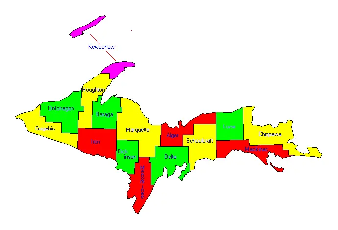
1. Official Marquette County Map Gallery & Locator
Below is the authentic United States Census Bureau and State GIS locator map depicting Marquette County highlighted along the south-central shore of Lake Superior in the Upper Peninsula:
2. Marquette County Geographic & Civic Profile (FIPS 26103)
This master administrative summary outlines the primary civic, demographic, and territorial benchmarks for Marquette County, Michigan:
| Administrative Benchmark | Verified Value & Data Point | Cartographic & Legal Context |
|---|---|---|
| State & Region | Michigan (Central Upper Peninsula) | Economic & Cultural Capital of the U.P. |
| County Seat | City of Marquette | County Courthouse located at 234 W. Baraga Ave. |
| Federal FIPS Code | 26103 | US Census Bureau spatial identifier |
| Date Organized | March 9, 1843 (Organized 1851) | Named in honor of French Jesuit explorer Jacques Marquette |
| Total Area | 3,420.8 square miles | Land Area: 1,808.4 sq mi (Largest in Michigan) | Water: 1,612.4 sq mi |
| Population (2020 Census) | 66,017 residents | Most populous county in the entire Upper Peninsula |
| Largest Municipality | City of Marquette (20,629 residents) | Followed by Ishpeming (6,140) and Negaunee (4,627) |
| Higher Education | Northern Michigan University (NMU) | Four-year public university serving over 7,500 students; home to the Superior Dome |
| Primary Water Bodies | Lake Superior, Lake Michigamme, Dead River Basin | Over 70 miles of dramatic Lake Superior coastal shoreline |
3. Municipal Directory: Cities, Mining Towns & Unincorporated Centers
Marquette County features three incorporated cities and numerous historic mining, lumber, and lakeshore unincorporated communities:
A. The City of Marquette (The Queen City of the North)
Serving as both the county seat and the commercial hub of the Upper Peninsula, the City of Marquette (population 20,629) is situated along the crescent-shaped shores of Marquette Bay on southern Lake Superior. Founded in 1849 as a deepwater port to export rich iron ore deposits discovered on the Marquette Range, the city combines historic 19th-century Jacobsville sandstone architecture with vibrant university life and world-class outdoor recreation. Key cartographic and civic landmarks include:
- Presque Isle Park: A 323-acre forested peninsula designed in 1891 by Frederick Law Olmsted (designer of New York’s Central Park), featuring ancient black basalt cliffs, the “Blackrocks” jumping cove, and panoramic views of Lake Superior.
- The Lake Superior & Ishpeming (LS&I) Ore Dock: Located at Upper Harbor, this towering 1,200-foot reinforced concrete and steel pocket dock towers 75 feet above the water, loading millions of tons of iron ore pellets into 1,000-foot Great Lakes super-freighters bound for Lower Great Lakes steel mills.
- The Superior Dome: The fifth-largest wooden dome structure in the world, covering 5.1 acres on the campus of Northern Michigan University and hosting NCAA Division II athletics, community trade shows, and Olympic training facilities.
- Marquette Harbor Light: Built in 1866 atop a granite bluff on Lighthouse Point, this historic two-story red brick lighthouse houses the Marquette Maritime Museum.
B. The Iron Cities: Ishpeming & Negaunee
Located 12 to 15 miles west of Marquette along US-41 and the Marquette Iron Range, Ishpeming and Negaunee form a legendary mining and cultural community:
- Ishpeming (population 6,140): Renowned as the historic birthplace of organized skiing in the United States, Ishpeming founded the National Ski Association in 1905. Today, it is home to the National Ski Hall of Fame and Museum, honoring America’s legendary winter Olympians and innovators. The city is also home to the historic Cliffs Shaft Mine Museum, featuring twin 97-foot obelisk-style concrete mine headframes.
- Negaunee (population 4,627): Celebrated as the birthplace of the Marquette Iron Range, Negaunee was founded in 1844 where surveyor William A. Burt discovered iron ore deposits after his magnetic compass fluctuated wildly due to underground magnetite ore. The city features the Michigan Iron Industry Museum, overlooking the historic Jackson Iron Company forge on the Carp River.
C. Unincorporated Communities & Historic Hamlets
- Gwinn & K.I. Sawyer (Forsyth Township): Located in south-central Marquette County, Gwinn was designed in 1908 by the Cleveland-Cliffs Iron Company as a “model mining town.” Nearby is the former K.I. Sawyer Air Force Base (operational 1955–1995), now functioning as Sawyer International Airport (MQT) and a bustling civilian residential and aerospace industrial park.
- Big Bay (Powell Township): Situated 25 miles north of Marquette at the terminus of County Road 550, Big Bay is nestled between Lake Independence and Lake Superior. It is home to the historic Big Bay Point Lighthouse (now a functioning bed-and-breakfast inn) and the Thunder Bay Inn (historic lumber hotel utilized in filming Otto Preminger’s 1959 classic Anatomy of a Murder).
- Michigamme & Champion: Western communities situated along the shores of Lake Michigamme (a 4,292-acre glacial inland lake), offering public boat ramps, historic 19th-century mining relics, and entry to the McCormick Wilderness.
- Palmer (Richmond Township): A historic mining community nestled at the base of the massive Tilden and Empire open-pit iron ore mines.
4. Comprehensive Guide to Marquette County’s 19 Civil Townships
Marquette County’s vast 1,808-square-mile landmass is organized into 19 civil townships administering local services, road maintenance, volunteer fire departments, and zoning:
| Township Name | Population (2020) | Land Area (sq mi) | Key Spatial Features & Infrastructure |
|---|---|---|---|
| Champion Township | 250 | 123.6 | Lake Michigamme, Peshekee River, US-41 and M-28 corridor; pristine boreal wilderness. |
| Chocolay Charter Township | 5,899 | 60.4 | South of Marquette along Lake Superior; Chocolay River, US-41 and M-28 junction at Harvey. |
| Ely Township | 1,904 | 139.8 | West of Ishpeming; Greenwood Reservoir, historic iron mining exploration tracts. |
| Ewing Township | 139 | 48.7 | Southeastern corner bordering Delta County; pristine Escanaba River timber acreage. |
| Forsyth Township | 6,346 | 178.6 | Gwinn model town, Sawyer International Airport (MQT), Escanaba River State Forest. |
| Humboldt Township | 429 | 95.5 | Humboldt Mill (nickel/copper processing for Eagle Mine), M-95 corridor to Iron Mountain. |
| Ishpeming Township | 3,392 | 87.6 | Surrounds City of Ishpeming; Dead River Basin, North Lake, Deer Lake impoundment. |
| Marquette Charter Township | 4,140 | 56.2 | Major regional retail commercial strip along US-41; Sugarloaf Mountain, Bishop Baraga Shrine. |
| Michigamme Township | 328 | 139.5 | Lake Michigamme northern bays, Craig Lake State Park (Michigan’s most remote wilderness park). |
| Negaunee Township | 3,232 | 43.3 | Surrounds City of Negaunee; Carp River valley, Michigan Iron Industry Museum. |
| Powell Township | 730 | 160.8 | Big Bay community, Lake Independence, Huron Mountains foothills, Eagle Mine portal. |
| Republic Township | 1,003 | 119.5 | Republic community, Michigamme River gorge, historic Republic open-pit iron mine. |
| Richmond Township | 834 | 57.1 | Palmer community, Tilden Mine open pit, Empire Mine tailings basins. |
| Sands Township | 2,374 | 67.4 | M-553 corridor, Marquette Mountain Ski Area, Sands Plains outwash plain. |
| Skandia Township | 826 | 71.8 | US-41 south of Harvey; Scandinavian agricultural settlement heritage, dairy farming. |
| Tilden Township | 1,012 | 96.8 | Active iron mining concessions, National Mine community, extensive hardwood forests. |
| Turin Township | 111 | 83.8 | Southeastern forestlands; Little Black River, prime timberland and deer hunting camps. |
| Wells Township | 213 | 155.6 | Arnold community, Escanaba River western branches, M-69 highway corridor. |
| West Branch Township | 1,623 | 35.6 | Crossed by M-94; Engman Lake, residential estates bordering Chocolay and Forsyth. |
5. The Marquette Iron Range & Modern Mining Economy
The geologic spine of Marquette County is the Marquette Iron Range—a 33-mile-long synclinal trough of Paleoproterozoic Negaunee Iron Formation rock dating back over 2.1 billion years. Mining on the range has operated continuously since 1845:
- The Tilden Mine: Located in Tilden and Richmond townships, this massive open-pit mine operated by Cleveland-Cliffs Inc. (CCI) extracts low-grade hematite and magnetite taconite iron ore. The on-site processing plant grinds, concentrates, and pelletizes millions of tons of iron ore into marble-sized pellets shipped across the Great Lakes to blast furnaces in Indiana and Ohio.
- Eagle Mine: Located in northern Powell Township, Eagle Mine (operated by Lundin Mining) is the only active primary nickel-copper mine in the United States. High-grade nickel-copper sulfide ore is mined underground and transported via dedicated truck routes along County Road 550 to the refurbished Humboldt Mill for flotation processing into export-ready concentrates.
- The Maritime Supply Chain: Ore trains from the Lake Superior & Ishpeming (LS&I) railroad transport pellets from the Tilden Mine directly to the Marquette Upper Harbor Ore Dock, where iconic 1,000-foot freighters load up to 65,000 gross tons of iron ore in less than eight hours.
6. Arterial Highway Corridors & Aviation Transit
Due to the immense distances of the Upper Peninsula, Marquette County’s transportation infrastructure serves as the primary regional transit crossroads:
- US Highway 41 (US-41): The primary federal arterial highway entering Marquette County from Escanaba in the south, traversing through Harvey, the City of Marquette, Negaunee, and Ishpeming, before continuing west toward Baraga, Houghton, and Copper Harbor in Keweenaw County.
- Michigan State Highway 28 (M-28): Michigan’s primary east-west Upper Peninsula highway runs concurrent with US-41 through the urban core of Marquette County, connecting east toward Munising and Sault Ste. Marie, and west toward Wakefield and Ironwood.
- Michigan State Highway 95 (M-95): Connects US-41 at Humboldt southward through Republic to Iron Mountain and the Wisconsin border.
- Sawyer International Airport (MQT): Located in Forsyth Township at the former K.I. Sawyer Air Force Base, MQT features a 12,370-foot concrete runway (one of the longest civilian runways in the Midwest), offering commercial airline service to Detroit Metro (DTW) and Chicago O’Hare (ORD) via Delta Air Lines and American Airlines.
7. Wilderness Preserves, Waterfalls & Four-Season Tourism
Marquette County is internationally celebrated as an outdoor recreation paradise, offering exceptional four-season adventures:
- Craig Lake State Park: Encompassing 8,459 acres in western Michigamme Township, Craig Lake is the most remote state park in Michigan. Accessible only by high-clearance logging roads or foot trails, it features six natural wilderness lakes, granite outcroppings, pristine portage routes, and resident moose populations.
- Epic Mountain Biking (Noquemanon Trail Network): Marquette is recognized by the International Mountain Bicycling Association (IMBA) as a Premier Ride Center, offering over 100 miles of singletrack trails traversing rocky granite ridges, river canyons, and coastal bluffs.
- Historic Waterfalls: Marquette County boasts over 75 named waterfalls, including Dead River Falls (a multi-tiered cascade descending 100 vertical feet through a volcanic canyon), Morgan Falls, Yellow Dog Falls, and Black River Falls.
8. Frequently Asked Questions (Marquette County Map)
Review these verified answers to the most common geographical and administrative questions regarding Marquette County, Michigan:
What is the county seat of Marquette County, Michigan?
The county seat of Marquette County is the City of Marquette, which is also the largest city in the entire Upper Peninsula of Michigan.
Which Michigan county has the largest land area?
Marquette County is the largest county by land area in Michigan, spanning 1,808.4 square miles of physical land (and over 3,420 square miles when including Lake Superior water territory).
What university is located in Marquette County?
Northern Michigan University (NMU), a four-year public university serving over 7,500 undergraduate and graduate students, is located in the City of Marquette.
Where is the U.S. National Ski Hall of Fame located?
The U.S. National Ski Hall of Fame and Museum is located in the City of Ishpeming in Marquette County, celebrated as the historic birthplace of organized skiing in America.
Where can I view an interactive map of Marquette County and all 83 Michigan counties?
You can explore all 83 Michigan counties with satellite imagery, zoom controls, and demographic data on our live interactive Michigan county map explorer, or download clean PDF study sheets on our printable Michigan county map hub.